v1.64.0
- Add LiDAR video creation tool
v1.63.0
- Add volumetric calculations
- Add delivery estimate
- Update names for exports
- Add trajectory to LiDAR visualizer
- Add ability to delete points
- Update measurement panel and styling
- Animate the auto-align tool
v1.62.0 (Rock 2.0)
- Add manual classification
- Substantially speed up Rock Cloud processing!
- Add xyz pointcloud handling
v1.61.0
- Add clone projects.
- Add ability to remove all photos
v1.60.0
- Add ability to hide deliverables when sharing projects.
- Add latitude/longitude headers to csv gcp upload.
v.1.59.0
- Misc performance improvements.
v1.58.0
- Misc bug fixes and upgrades
v1.57.0
- Add suggested projections based on project location
- Misc bug fixes
v1.56.0
- Add software download links to cloud.
- Redirect new users to shared projects.
- Note if a GCP is disabled in the accuracy report.
- Make LiDAR toolbar resizable.
- CSV download for measured points in the LiDAR toolbar.
- Upload and display kml/kmz files on project maps
v1.55.0
- Move back to Strip only checkout and use Stripe sales tax calculation.
v1.54.0
- Add receipt for ordered jobs
- Update token log to be more informative.
- Add user menu
v1.53.0
- Misc bug fixes
v1.52.2
- Add support for geoid12b and geoid18b.
- Add support for combined scale factor.
v1.52.1
- Minor bug fix.
v1.52.0
- Edit the displayed classifications. Change the color, title, and add new classifications all within the LiDAR visualizer.
v1.51.0
- Limit classifications of exported pointcloud data.
v1.48.1
- Auto Align to GCPs
- Add ROCK Cloud processing time estimate.
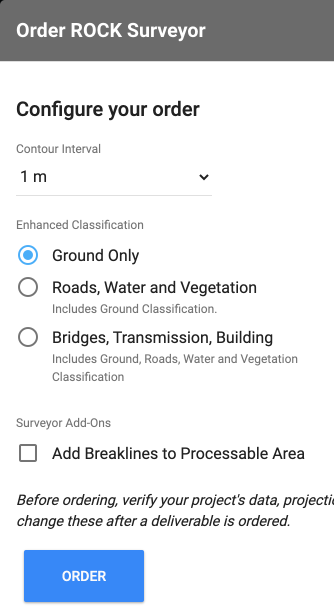
- Order “Enhanced Classifications” and Breaklines with ROCK Surveyor!
v1.48.0
- Folder sharing!
v1.47.0
- Add ability to set vegetation encroachment distance for Rock Vegetation Management.
v1.46.0
- Add global message feature to send messages to logged in users.
- Display project GCPs in Compare view
v1.45.0
- Add Chatbot help.
- GCP visibility gets saved in the LiDAR view.
v1.44.0
- Upload geo-referenced photos to a project and view them on the map view.
- Purchase ROCK Hydrology by only paying the additional cost for the selected enhanced processing area. This dramatically decreases the cost of ROCK Hydrology.
- Set Project defaults on your user → edit page. These project defaults will be used on all future projects created.
v1.43.0
- Export data as grid.
v1.42.0
- Minor bug fixes
v1.41.0
- Designate ground control points as checkpoints
- Disable ground control points
- Add a note for a ground control point
- If an accuracy report has already been created and you change your ground control points, then the Accuracy Report will be re-created using the updated ground control points.
v1.40.0
- Toggle Compass in LiDAR viewer
v1.39.0
- Bug fixes
v1.38.0
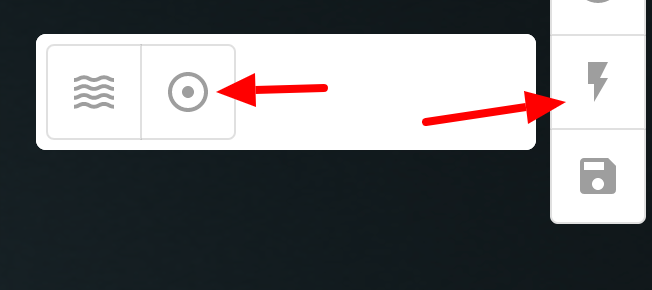
- ROCK Surveyor ‘Reprocess’. Did you find your LiDAR data to be off from your GCPs based on your Accuracy Report? Simply move the dataset and select ‘Reprocess’ on the deliverable to update the classified point cloud, DTM, contours, and accuracy report!
- GCP csv uploader now attempts to determine your columns based on the naming.
- Upload your R1A/R2A trajectory file to view in the Rock Cloud.
v1.37.0
- The ROCK Cloud will now give you information about the projection your uploaded LiDAR files are in. In some cases it will even pre-fill the projection information on your project.
- Business users now have the ability to be ROCK Stars! Join our community and share your projects!
v1.36.0
- Export deliverables and convert your pointclouds and vector files before downloading.
- Download shapefiles as DXF.
v1.35.0
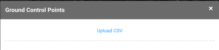
- CSV upload for GCPs.
v1.34.0
- Business logo added for Business users. The logo will be displayed on all projects created by a business user.
v1.33.0
- Merge projects within a folder.

- GCP handling added for Pro users.
v1.32.0
- Save pointcloud translations from folder view.
- Sort obstructions in Obstruction Report based on nearest neighbor.
- Add token calculator to Marketplace items.
v1.31.0
- Allow customers to choose ‘processable area’ when ordering ROCK Planimetrics. This allows customers to select a subset of their scan for processing.
- Add configuration options for ROCK Vegetation Management and ROCK Planimetrics. This includes Corridor Width, Planimetric Resolution, and Rural, Semi-Urban, Urban selection.
- Updates to the checkout/payment flow.
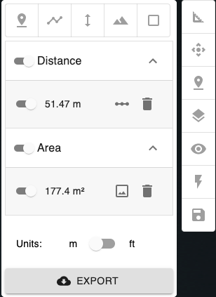
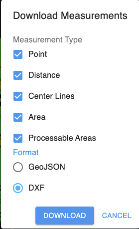
- Export measurements to DXF or geoJson file.
Select ‘EXPORT’:
Select ‘DOWNLOAD’
v1.30.0
- Allow ordering ROCK Vegetation Management by the mile instead of by the acre.
v1.29.0
- Auto submit file uploader to begin processing visualizer sooner for large uploads.
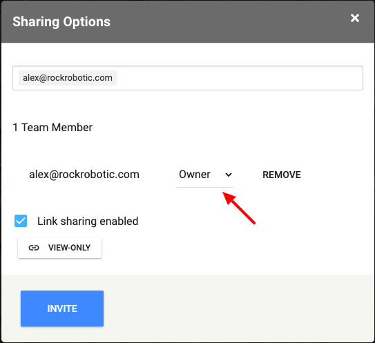
- Add ability to share ownership of a project.
v1.28.0
- Add automated Obstruction Report for ROCK Vegetation Clearance.

v1.27.0
- Update automated email language.
- Add ability to select export file type (las, laz, xyx)
- Add notice if customer is using an unsupported browser.
v1.26.0
- Allow for uploads up to 100 GB per file and add a new file handler.
v1.25.0
- Add vegetation violations to the map view.
v1.24.0
- Allow for selecting custom LiDAR classification schemes.
v1.23.0
- Add real-time end-user messaging to tell users about the progress of their project processing.

v1.22.0
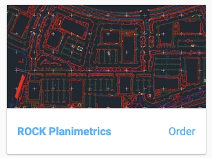
- Add ROCK Planimetrics
v1.21.0
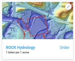
- Add ROCK Hydrology
v1.20.0
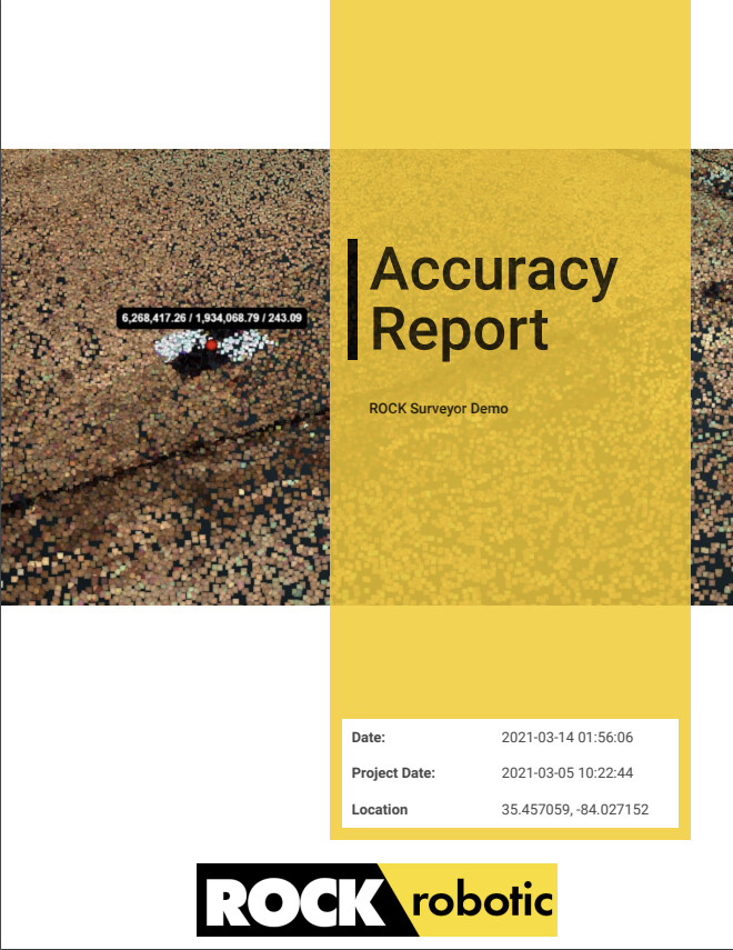
- Create automated pdf GCP report
v1.19.0
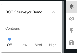
- Add low/medium/high resolution for contour display
v1.18.0 Release Notes
- Point Cloud Compare

- Move project location in map view

- Allow pts, ply, and e57 point clouds in addition to las and laz.
v1.17.0 Release Notes
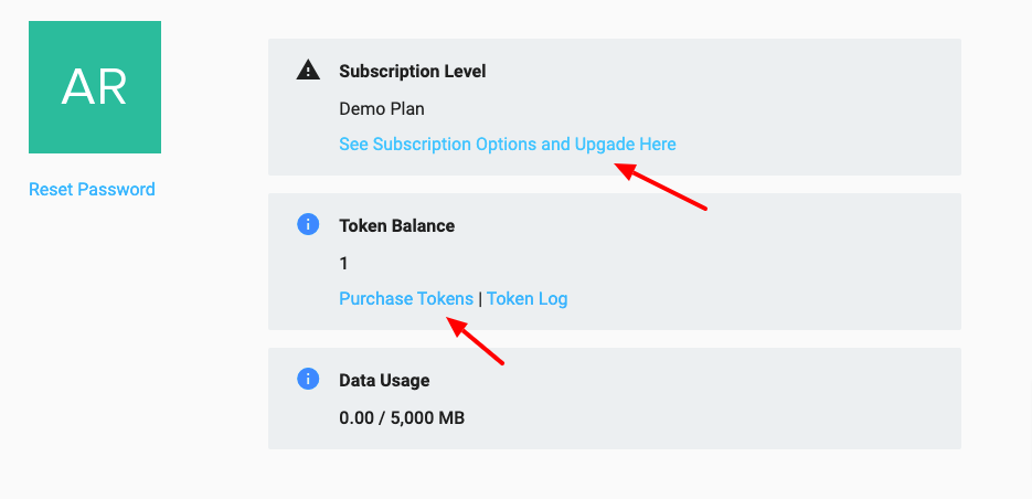
- Self-serve token and subscription purchases
v1.16.0 Release Notes
- Add BayesMap Strip Align to the marketplace.
v1.15.0 Release Notes
- Move Deliverables into sidebar
- Add Marketplace to sidebar
v1.14.1 Release Notes
- Various bug fixes
v1.14.0 Release Notes
- Update project projection creation.
v1.13.0 Release Notes
- Update GCP handling within LiDAR viewer.
v1.12.0 Release Notes
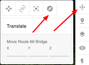
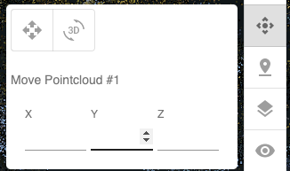
- Add ability to move the point cloud. This is especially useful to correct for deviations from ground control points.
v1.11.0 Release Notes
- Re-design project creation and edit.
v1.10.0 Release Notes
- Add ability to select and reproject the vertical projection of a point cloud.
- Display demo projects on ‘My Projects’ page
v1.9.0 Release Notes
- Add ability to save lidar visualizer configuration via toolbar
v1.8.0 Release Notes
- Add ability to move point cloud X, Y, Z on export.
v1.7.0 Release Notes
- Misc bug fixes
v1.6.0 Release Notes
- Add folder structure to project view
- Misc bug fixes for LiDAR visualizer
v1.5.0 Release Notes
- Add OGC WKT projection strings
v1.4.0 Release Notes
- Add marketplace
- Add cookie consent
- Add ability to organize users in an Organization
- Add email notifications on processing jobs complete
- Update projections
- Add free tier notification popup
v1.3.4 Release Notes
- Add project tagging
v1.3.3 Release Notes
- Add filtering and sorting to project page
v1.3.2 Release Notes
- Add project map view
- Update project create/edit page styling
v1.3.1 Release Notes
- Add Free tier
v1.3.0 Release Notes
- Allow for deg min sec on GCPs
- Update GCP help text
- Add link sharing by link.
v1.2.8 Release Notes
- Add project sharing by email address.
v1.2.7 Release Notes
- Add contour visualization.
v1.2.6 Release Notes
- Minor fixes for trajectory selection.
v1.2.5 Release Notes
- Minor fixes for trajectory selection.
v1.2.4 Release Notes
- Add Acquisition Vehicle taxonomy to Project.
v1.2.3 Release Notes
- Update internal notifications
v1.2.2 Release Notes
- Minor bug fixes
v1.2.1 Release Notes
- Added LAS and LAZ automatic processing.
v1.2.0 Release Notes
- Added the ability to select your flight lines for processing.
v1.1.0 Release Notes
- Added subscription status in menu sidebar
- Added Power Line classification as an option for ROCK cloud processing
- Added ability to upload photos of ground control points and base station
v1.0.0 Release Notes
- Create a free account using industry security leader Auth0.
- Project listing page.
- Create a new project and upload your R1A data.
- Submit your data for processing.
- View demo projects.
- Use the Rock Cloud Data Visualizer to manipulate and analyze your data.
- View ground control points on the map view and LiDAR view.
- Save annotations and the default view for your LiDAR data visualizer.
- Measure area using the Area Measurement tool.
- Measure distance using the Distance tool.
- View LiDAR data based on ground classification.
- View height profile of LiDAR data.