I need to export a flight into State Plane (using Rock Surveyor) I have survey control shots in state plane, and I want to properly upload and process my data to get survey contours.
Can we get a little step by step? For example, selecting “Ellipsoid” and the vertical datum is something I’d need highlighted and anything like that.
I appreciate all y’alls help. In just a few flights I’ve gone from clueless to decent!
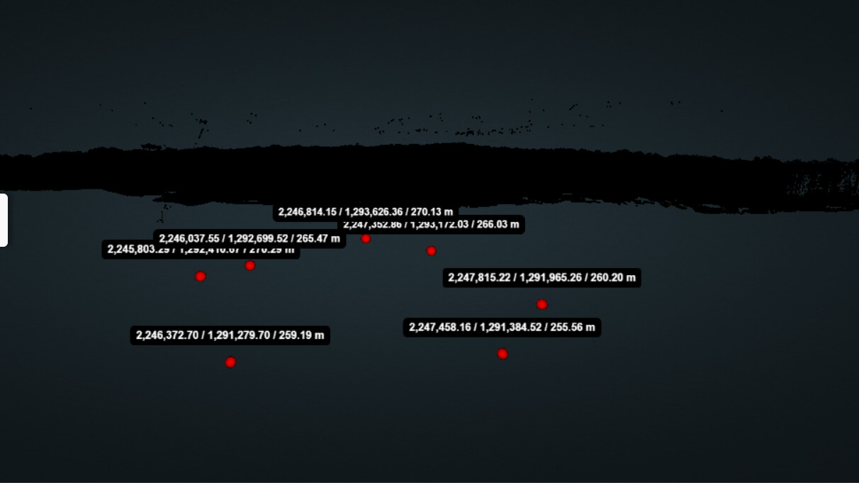
So I added all these ground control points and each one looked basically dead on or maybe within a few tenths of a foot. I used UTM Easting/Northing and Meters for elevations. Then when I selected state plane to get 1 foot contours instead of 1 meter contours it turned into the attached.
I tried to process it anyway because I need the topo asap and I took a chance but I just want it to be easy to get 1 foot contours instead of accidentally messing it up. I know making these things is hard I’m just including this so others won’t have the same initial struggle and it can be easier to onboard new customers.
Thank you for the messages. We are constantly trying to improve the documentation and appreciate you trying to help as well.
The general process of processing in the cloud is:
Upload your LiDAR data.
Select the uploaded projection and select to reproject (if desired).
Everytime you upload data and/or change projection our system tries to update the visualizer. This can take a few minutes of processing each time new data or re-projections happen. Likely what happened is the UTM projection got processed first and the State Plane projection was still in the queue to be processed.
Your data now appears to be in feet and in the state plane projection.
One thing I guess I messed up on is when I lowered my point cloud I either A) didn’t hit save or B) didn’t wait for the data to process and my deliverables were all at the wrong Z value, like I hadn’t adjusted them. I just fixed my DTM points in CAD but just wanted to point that out as something that may be confusing.
Is there a place I can see all of the projections? I have a client that tells me the points were observed with the MO VRS network. Nad 83 with a geiod 12B. How do I put my project into that grid?
It would be nice if there were a drop down of projections. Also It would be nice if I could just upload a CSV with the projections. Pick from the drop down of what datum to project the lidar and GCPs in? I don’t know if this makes sense but I have a project for a client I am trying to get done. I need help.
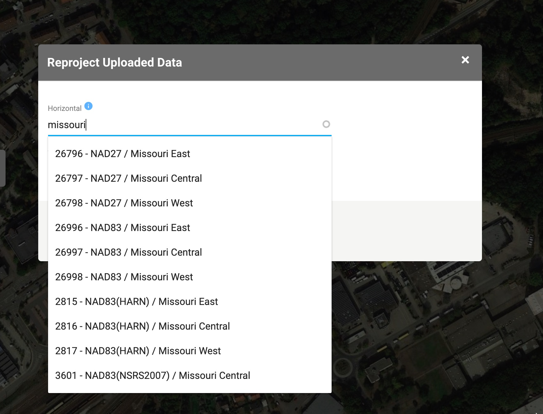
Like Daniel was saying it looks like you are going to be in Missouri East, Central, or West. You just need to look at the state plane map and see where you were. The surveyor also told you NAD83. So in the ROCK cloud you would click reproject data then you get the pop-up and I would first type in Missouri
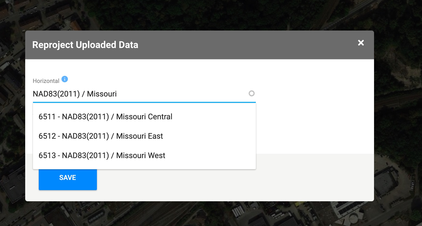
Then I can see some options. If you dont see your correct option, you can start to refine the search. For example, maybe I want to find NAD83(2011) / Missouri East
You can see that option isnt visible, but now that I know Missouri East goes after the / , I can put NAD83(2011) / Missouri … here is a screenshot of that: