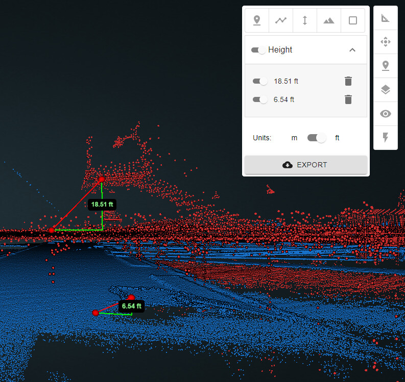
I am running into some issues where I am comparing projects and it seems there is an issue with the projections. PCMaster’s default is WGS84 UTM, but I selected to reproject into stateplane and compare it with previous LiDAR, which is in stateplane and I am seeing anomolies that do not look like they can be resolved by simply translating. It looks like the imported pointcloud has a vertical exaggeration of 3x (thinks its in meters? original projection was stateplane feet) and the PCMaster generated pointcloud looks flattened. Another weird thing is that when I open each cloud in a separate window to take a few height measurements they are off from how they measure when they’re being compared side by side in the same viewer… See attached image of the different heights measured from the different clouds in the compare feature.
@Alex Thanks for the reply. I re-uploaded the pointcloud and re-projected with 6360 but am seeing the same discrepancies. I waited until I got the automated email saying it was updated and ready to view too. Any other suggestions?
Also, why would the clouds measure differently when they’re in the compare view vs when they’re by themselves?
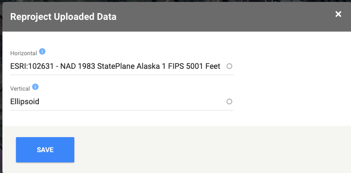
I have adjusted the workflow so that I am setting the CRS and the reprojection CRS prior to importing a pointcloud. Unfortunately the problem persists when I am reprojecting from the WGS84 UTM (m) Ellipsoid to Stateplane and NAVD88 (ft).
Looks like there may be something going on in the backend where I cannot do anything.
I have shared my projects with Matt. Would love an update as soon as there are ideas or suggestions.