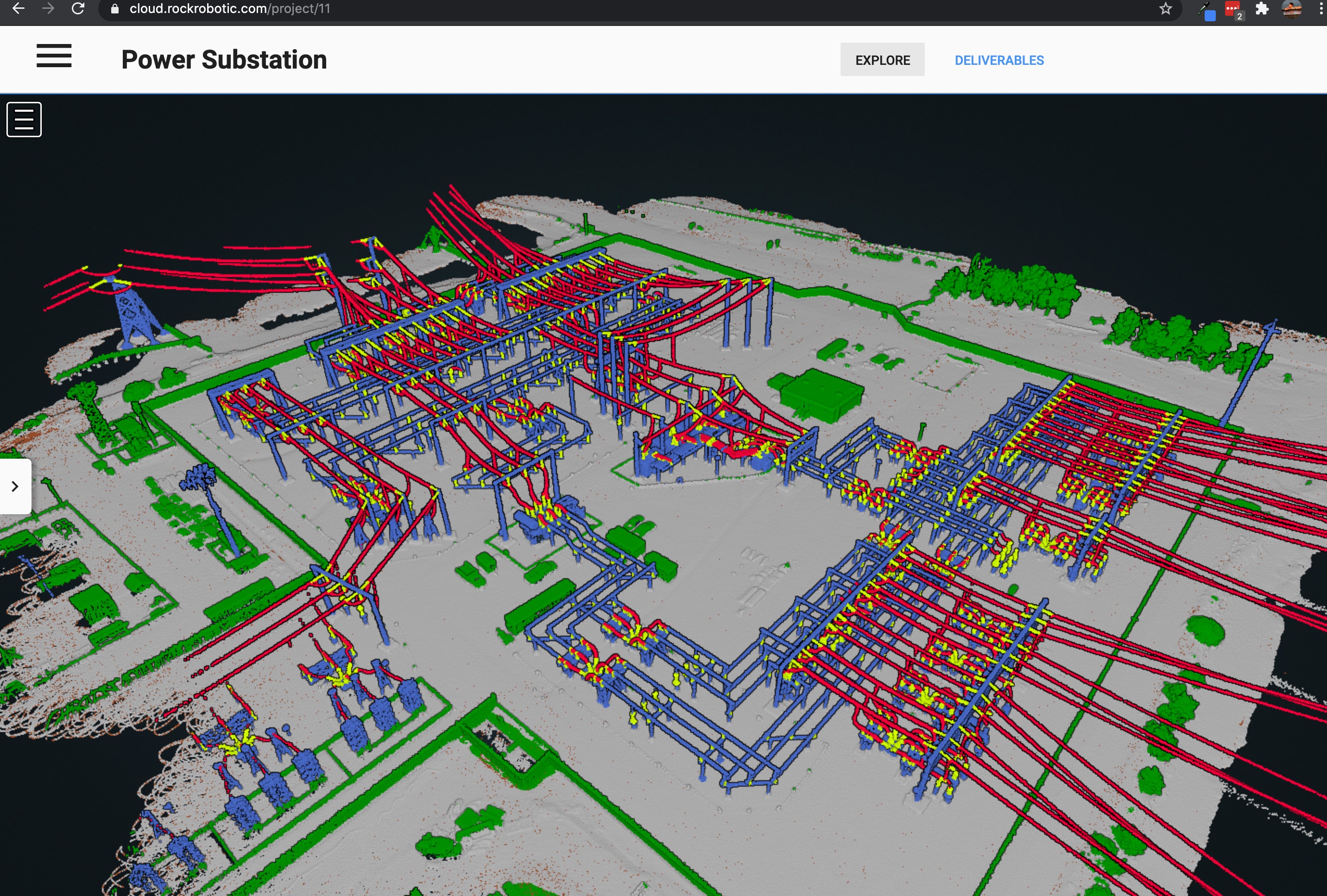
Data captured with the ROCK R1A on the DJI M210 drone. The approximate time for flying the mission, including equipment setup and tear-down, was 1 hr. For the complex structure, a cross-hatch mission was flown to capture the best detail.
Alex. Thanks for sharing. What was the payload used? Do you have any technical specifications on the capture you could share? I’m curious about the points per square meter. Thanks!
This project was flown with the ROCK R1A. You can see the flight lines on the map view on the project. You can see all of it on the free version of the ROCK cloud. Just go to cloud.rockrobotic.com and log on or create an account. Then you can go to the Power Substation project and see all the details.
I believe it is over 800 pts/m2 I will double check. It is also classified too! looks crazy good.