Have you encountered a vertical separation (Example: 2 or more roofs where there should be only 1) in your dataset? Well, you’re not alone. The good news is that its usually a pretty easy fix.
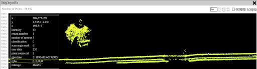
Most likely this is due to your base station not collecting enough satellites to give you a proper PPK position. If you have less than 15 satellites then you very well might see these issues present themselves.
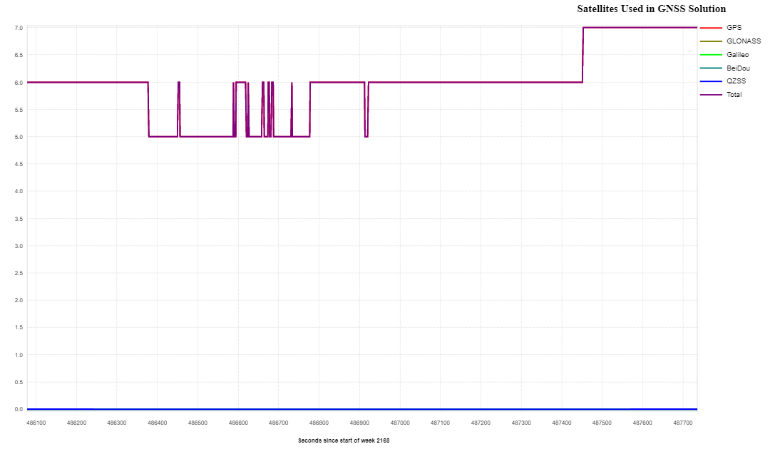
5-7 satellites! Uh Oh

Position quality all over the place! Uh Oh
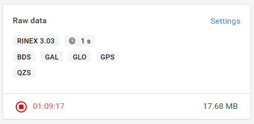
Simple solution!! Make sure you have all the constellations possible enabled on your Base Station. If you are using an Emlid Reach RS2 then these are your desired settings:
Beidou, Galileo, GLONASS, and GPS, QZSS is just bonus.
1s Intervals
Rinex 3.03
However that doesn’t help you at all if you already did your scan and you can’t/won’t go back to redo it. So what now?
Use a CORs station nearby if possible or if there is no other solutions. (CORS MAP)

Luckily for us there is a fairly good network of base stations across the nation that we can use the RINEX files from, and if we are lucky they will also be capturing at 1s intervals and using multiple constellations themselves. If one of these isn’t close you may have to go ahead and head back out there and try again with your correct settings and retry.
Once you find one that might work. Go to the specific site and check the data if it’s 1s intervals you might be in luck! Go ahead and input your parameters and download your new RINEX file.
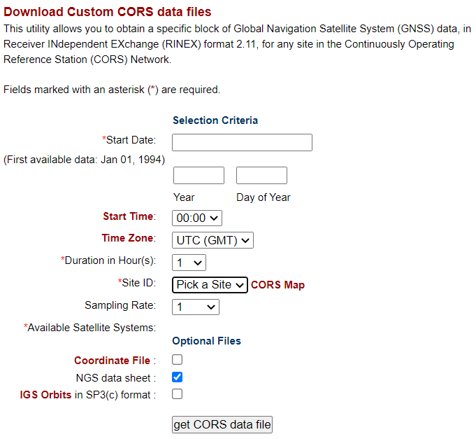
Note: When in doubt, pick a 24 hour time period (it’ll add to your pre-processing time, but not too much)
With that enjoy your new aligned dataset and make sure to have the correct settings next time!