Hi everyone,
I’m new to Rock Robotic, but interface and use seems easy to handle.
 I’ve uploaded a .laz file without problems.
The CRS was read well out of the project file:
(Horizontal: Belge 1972 / Belgian Lambert 72 - EPSG:31370 Unit:m)
(Vertical: Ostend height EPSG:5710 Unit:m)
no Reproject needed as we want the output in same CRS (Am I correct?)
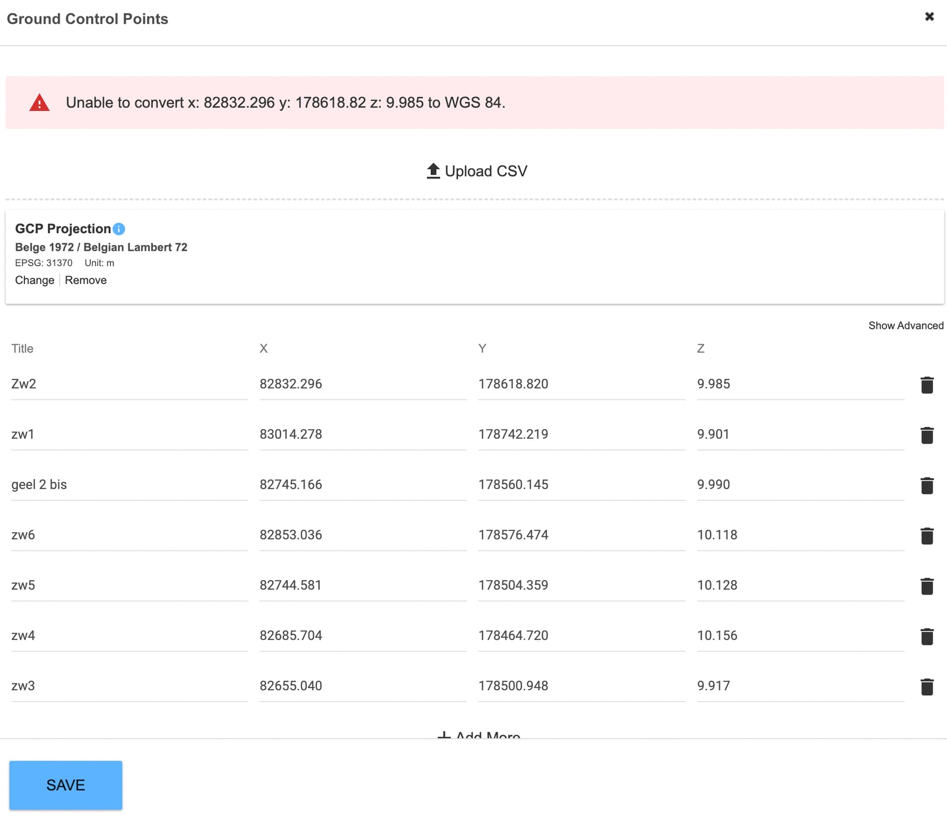
Still, I’m suffering at the step “Add Ground Control Points”. (see screenshot)
 I receive the error “Unable to convert x: 82832.296 y: 178618.82 z: 9.985 to WGS 84.”
The GCP data is in Belge 1972 / Belgian Lambert 72, but as we select this as GCP Projection, we receive the error message.
Uploading GCP data in WGS 84 gives another error that it cannot convert to Belgian Lambert.
Can someone help us with this? Thank you?