We are consistently seeing double-point clouds on the last 4 projects. In portions of each site, the point clouds are ±1.5ft parallel in elevation to each other.
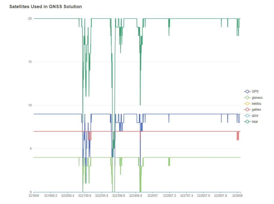
Notice both the number of satellites and the big dips in your plot.
I see you are using a Virtual RINEX observation data file. This appears to be the issue. Can you process with a single point base station file that was located within a reasonable distance to the data collection?