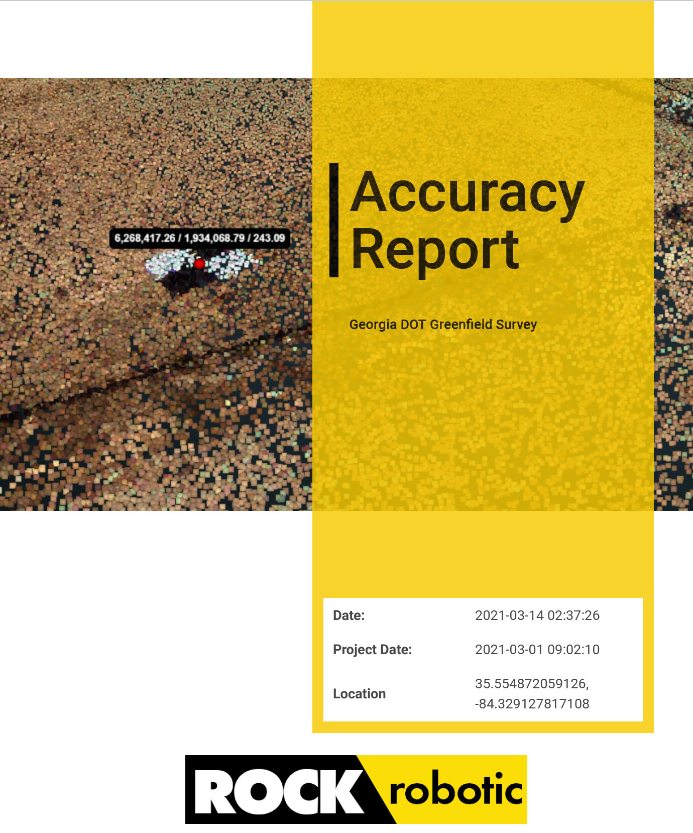
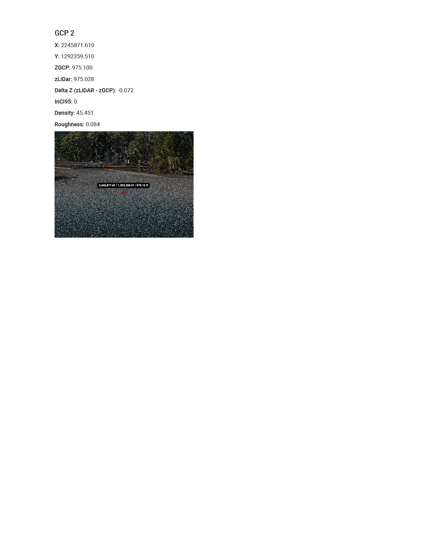
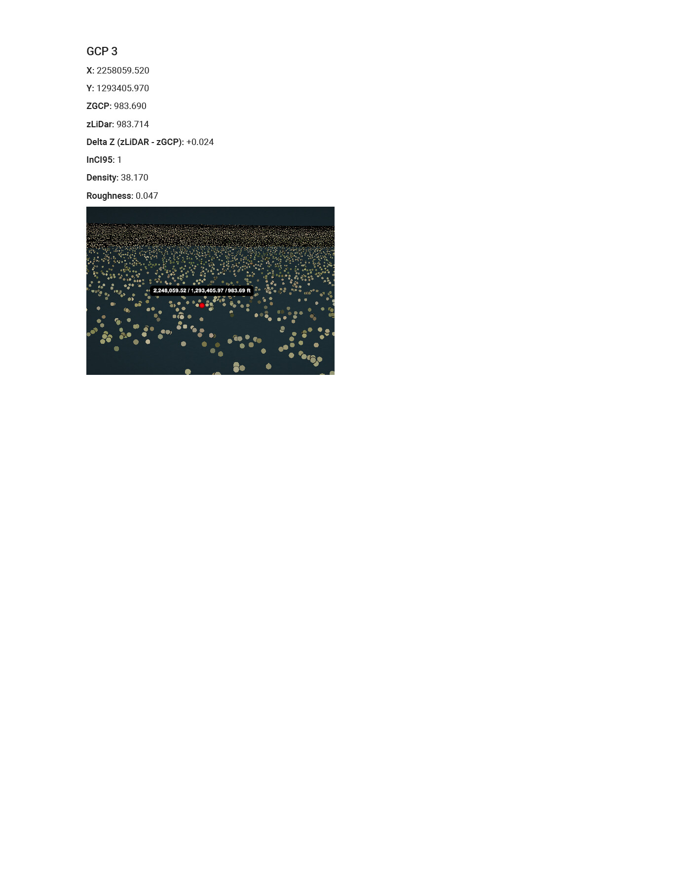
The ROCK Cloud now provides a ground control accuracy report when you have the ROCK Business Plan and you process your data with the ROCK Cloud!
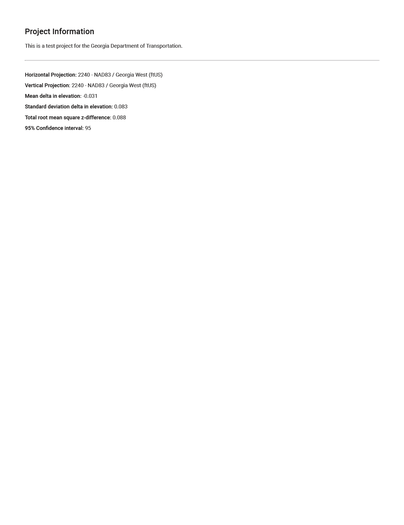
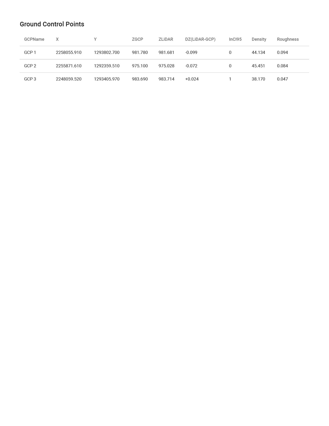
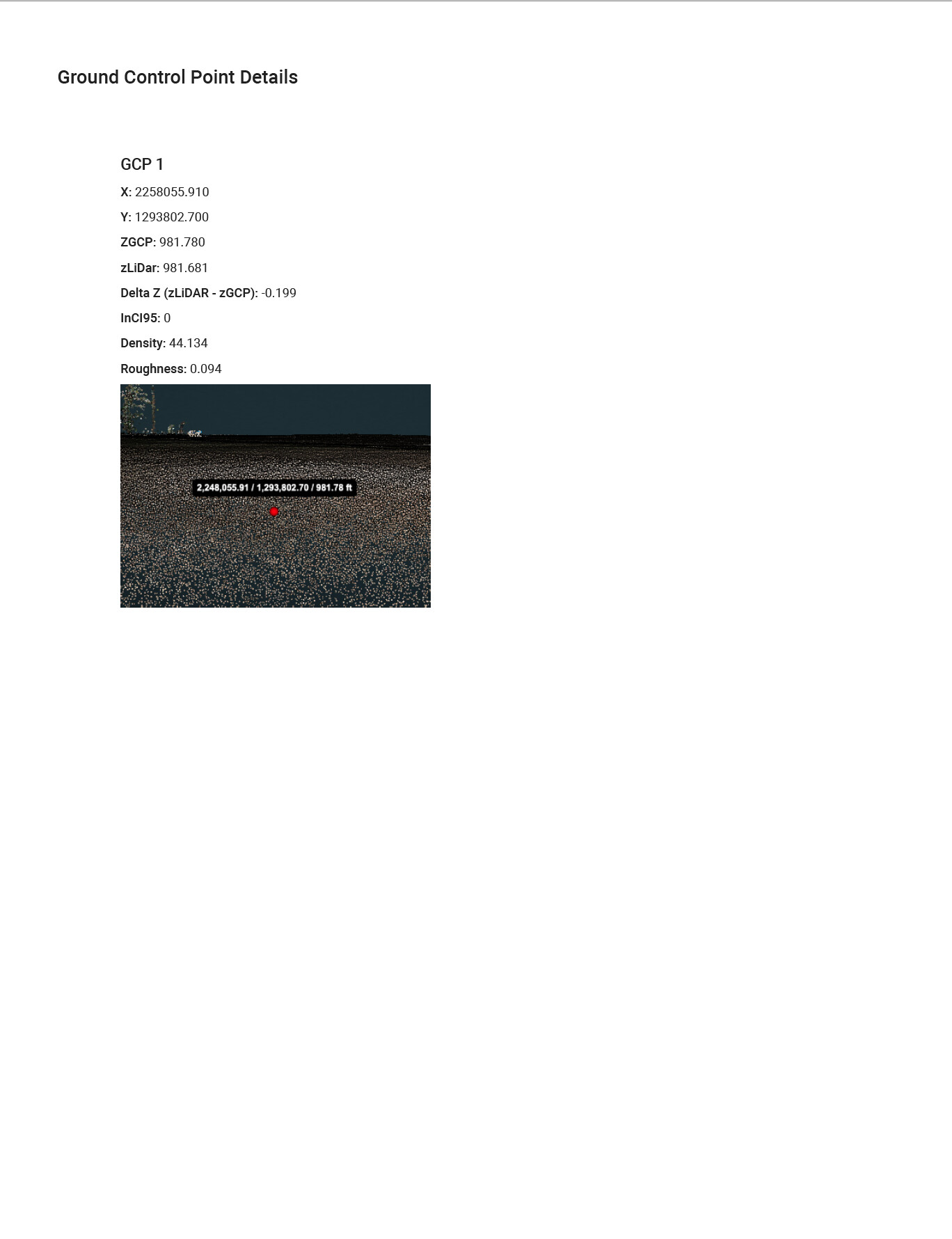
The ROCK Cloud will take all of your Ground Control Points and calculate the deviation from the ground classified LiDAR data along with other useful metrics. When the report is generated, information from your project (Title, Description, GCP Photos) will be included in the report. Simply save the pdf and look like a ROCK Star!
It processes the ground control points as they are at the time the job is initiated. If they are added later, then they won’t be included.
The photos that are added to the report are the photos that are uploaded to the gcp under “Additional customizations”. We are working to automatically add screenshots from the LiDAR data like the above. But those from the example above were screenshots and uploaded to additional customizations.