I’ve got a new one… 
We flew an airport in two parts (~260acres each).
Given issues of sat coverage in the past, we had the base logging RINEX 3.03, at 1hz for: GPS, GLONASS, and GALILEO.
After the AM flight we stopped logging on the RS2, grabbed the .21O file (left the unit setup and powered on over our known point) and pre-processed the project in the field as a QC check (worked great). Once done we logged back into the RS2 and started a new logging run.
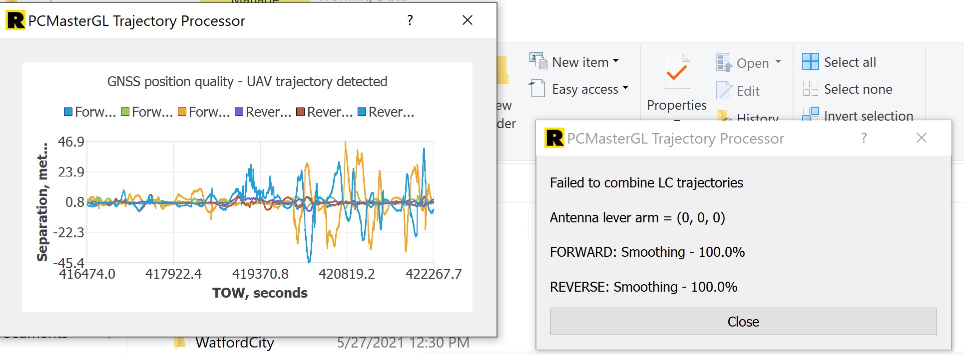
After flying the second area (finishing 3hr after the first) we grabbed the base .21O file. howerver the header location was over 60 miles north of us, and the elevation was roughly 10 meters off… see pic. Same site, same setup as the AM flight/log, but way off…
Tried processing anyway but as anticipated got an error:
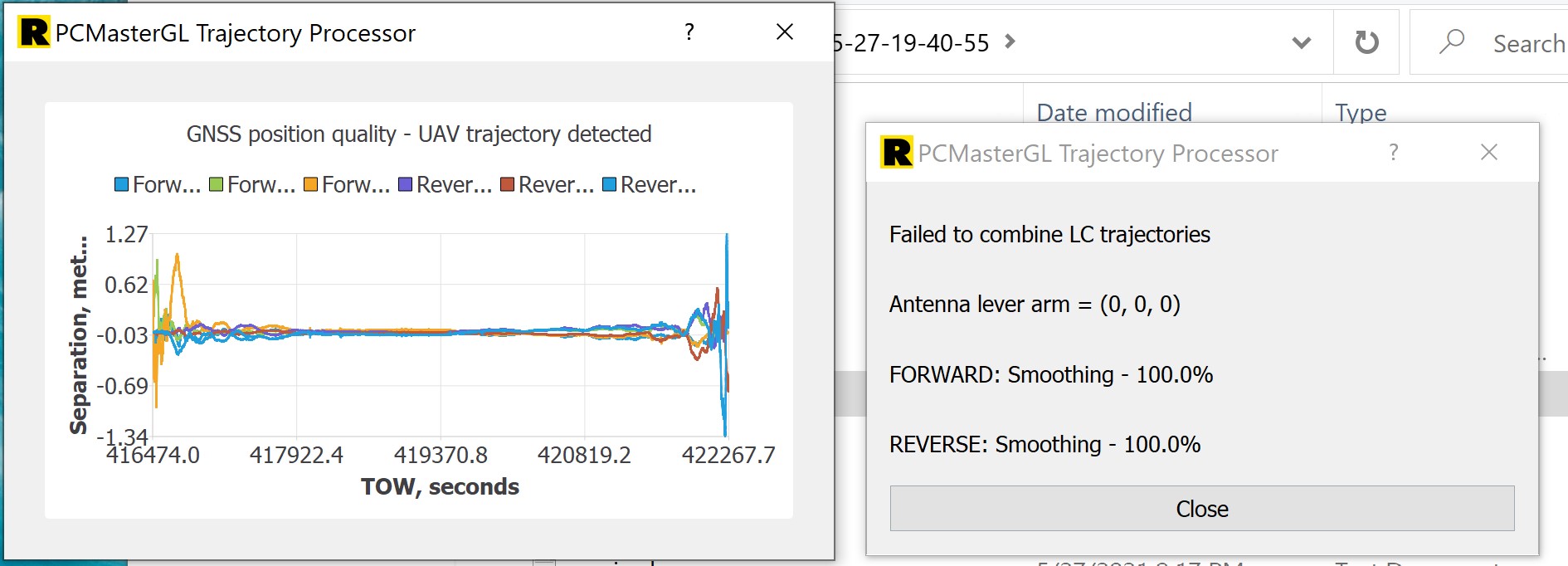
So, assuming is was a bust in the base file, we grabbed the nearest CORS station. Header info came in dead on, but the LC Trajectory error percisted, even after scrapping the folder and re-starting with a fresh copy from the flash drive.
Notice the GNSS is better quality, but not the same and still not good.
Thoughts? Ideas? Solutions?
Side note: when we stopped the RS2 it started to “compress” its log files (we were no where near any size limits at ~11MB). It hung at 79% so after waiting ~10 minutes I rebooted it and grabbed the file. that may have been my big mistake (usually I just shut it down without stopping the log), but does it explain the failure of the CORS data?
So the data didn’t finish compressing before you shut it down, and that is the file you’re having trouble with right?
@navigator Do you have any thoughts on this LC Trajectory issue?
yep on the RS2, but the nearby CORS file didn’t work either.
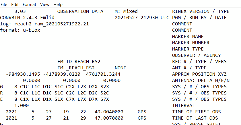
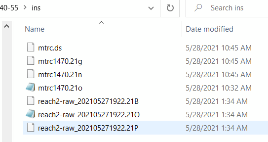
My first thought is you grabbed the wrong base file for the second processing. It failed the LC because there was no time overlap. Additionally, its not just the .21O… You need all the files, .21O .21B .21P. or whatever other rinex files are produced.
It would be easier to answer if the .gps and the .imr files were shared. I can download the CORS data myself, but if the RINEX is shared, too, I can try to replicate the issue exactly. I have a feeling that one of the directions (most likely, reverse) is failing to align due to backward motion, but can’t confirm without data.
zip folder shared via rock cloud to Harrison 
Sadly, I thought of that and triple checked those time windows on the RS2 files.
files in folder:
This error is most often caused by the calibration portion of the flight not being executed properly. Make sure while flying you are doing the flight forward, figure 8’s, performing the mission, flight forward at return to give the software the ability to solve for orientation.
See here for a deeper dive or refresher on calibrating the LiDAR. This applies to both NADIR flights and the Facade Mount Flights.
Calibrate the R2A
What timely information!!
1 Like
that’s okay… its still good for the community.