I would like to open up a R3 PRO conversation and share results on making our flights as efficient as possible. Each use case will be different depending on the expected outcome of results. With that being said my next flight will include the following as a test.
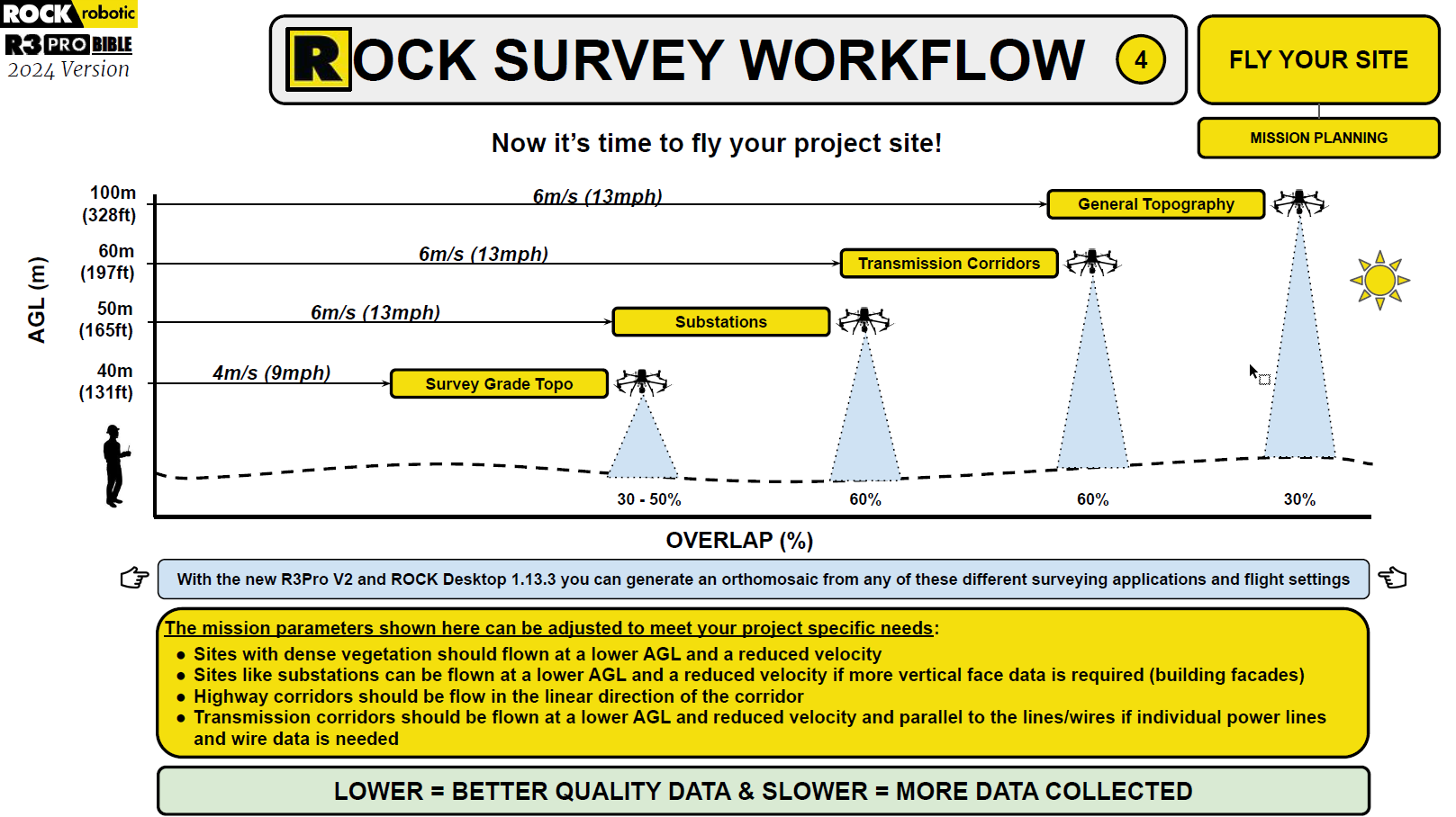
Application - General Topography
Scan Height - 375 AGL
Overlap - 35%
Speed - 22mph
Drone Model - M300
Total Acreage - 567
Estimated flight time - 37m 21s
Type of vegetation - Raw / cleared land in SE TX
I have about 20,000 acres ahead of me to capture this year. My goal is to make these flights as clean as possible. They range anywhere from 50 acres to a couple thousand at a time.
To me these flights tie into every other item on the workflow that takes up most of our time. Everything from strategizing your GCP’s to pre and post processing. Additionally not only is time being saved but every battery hot swap avoided is me avoiding the risk of losing data.
Thankfully the Rock team has streamlined most of the process for us and continues to do so further. This part of flight efficiency I think the community can really work together on.
Thank you Alex for suggesting reaching out to the community!
I’ll comment an update and share my results along with any hurdles and how I overcame them in the next few days.
This is awesome @jonathan.neal! I am very interested to hear everyone’s experience with different flight parameters! If we get traction on posts like this I’ll create a new section of the community to post these kind of trials!
Small update, as a smaller sample test I captured a 56 acre plot of land at 375ft and 22 mph and then again at 33.5 mph. The biggest quality differences I found between these captures and my typical 180ft at 15mph or less was the surface smoothness and minimal side profiles of anything vertical. Overall the captures are still usable by my team for capturing the surface. If I wanted to show utility and other infrastructure better I would have to come down in altitude being that the height itself had more impact than speed from my tests.
My next capture will be 1047 acres again at 375ft for the sole purpose of capturing the surface. Keep in mind this is a freshly developed/cleared area with minimal trees and vegetation.
Something else that surprised me was RGB photos still turned out rather decent. We won’t personally be using RGB for visualization for this effort but if I was going to I would also want to fly lower for higher point density for the image overlay.
The 1047 acre capture ended up being 1203 acres. 35% overlap 375ft and 33.5mph.
Overall it was a great success. We were able to capture the surface and slopes incredibly well even with those flight parameters. To sum it up our engineer confirmed the "existing elevation hard surface checks are within 0.1’ " and “I couldn’t have hoped for a better end result.” With that being said we were still able to maintain great accuracy for our use case. It helps when your engineers are familiar with point clouds.
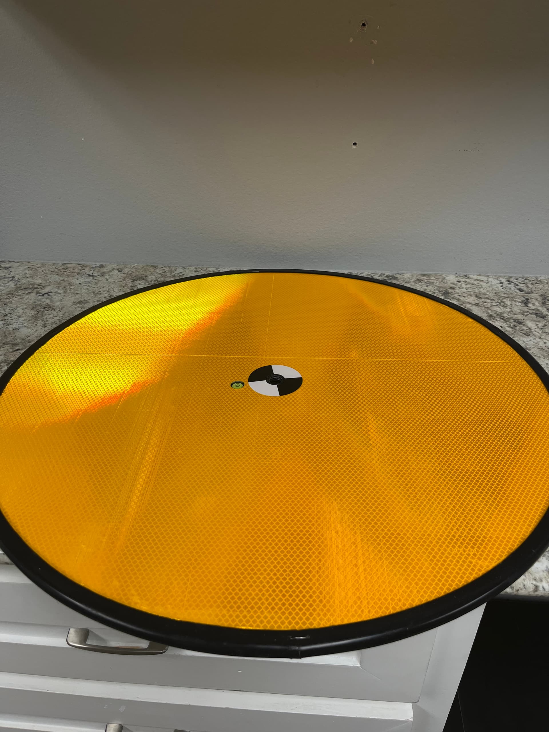
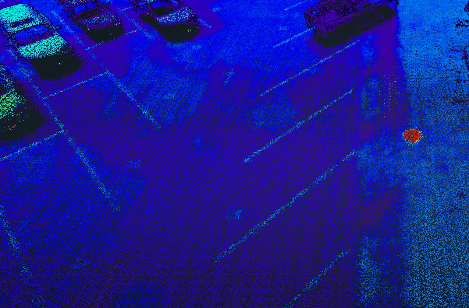
Next week we will be capturing a couple thousand more acres with the same flight parameters. I will also be testing some new custom ground targets. My hopes are I can get even better visualizations of the ground targets with the right material.
Jonathan! Curious about how your projects have been coming along. Sounds like your tests were successful, have you been having continuously good results? Are you using any of ROCK’s deliverables or doing all processing elsewhere? Thanks!
Roughly 4,000 acres captured with great results. Arguably the slower and lower flight point clouds look cleaner pre processing for sure. However, the surface post processing looks identical when compared. If we were doing smaller captures I am sure I would use Rock’s deliverables but our engineers are using another solution to process the surface.
Sorry for the late reply I have been swamped. I am running a couple flights next week and will post some target results. I am also going to custom make a few smaller ones to try and help with precision.
With your vegetation type it will be difficult to go any higher or any faster. 60% overlap is a good rule of thumb but maybe overkill. Looks like you may have one hotswap in that flight which isn’t too bad at all.
Most of my flights are elevation checks/ General Topo of cleared and mid developed land; allowing me to fly faster and higher with less overlap.
You should get really good results with your current flight settings/type of vegetation. We flew at different settings and compared the surface deliverable to see what worked best for us.
Is the 500a site also high vegetation?
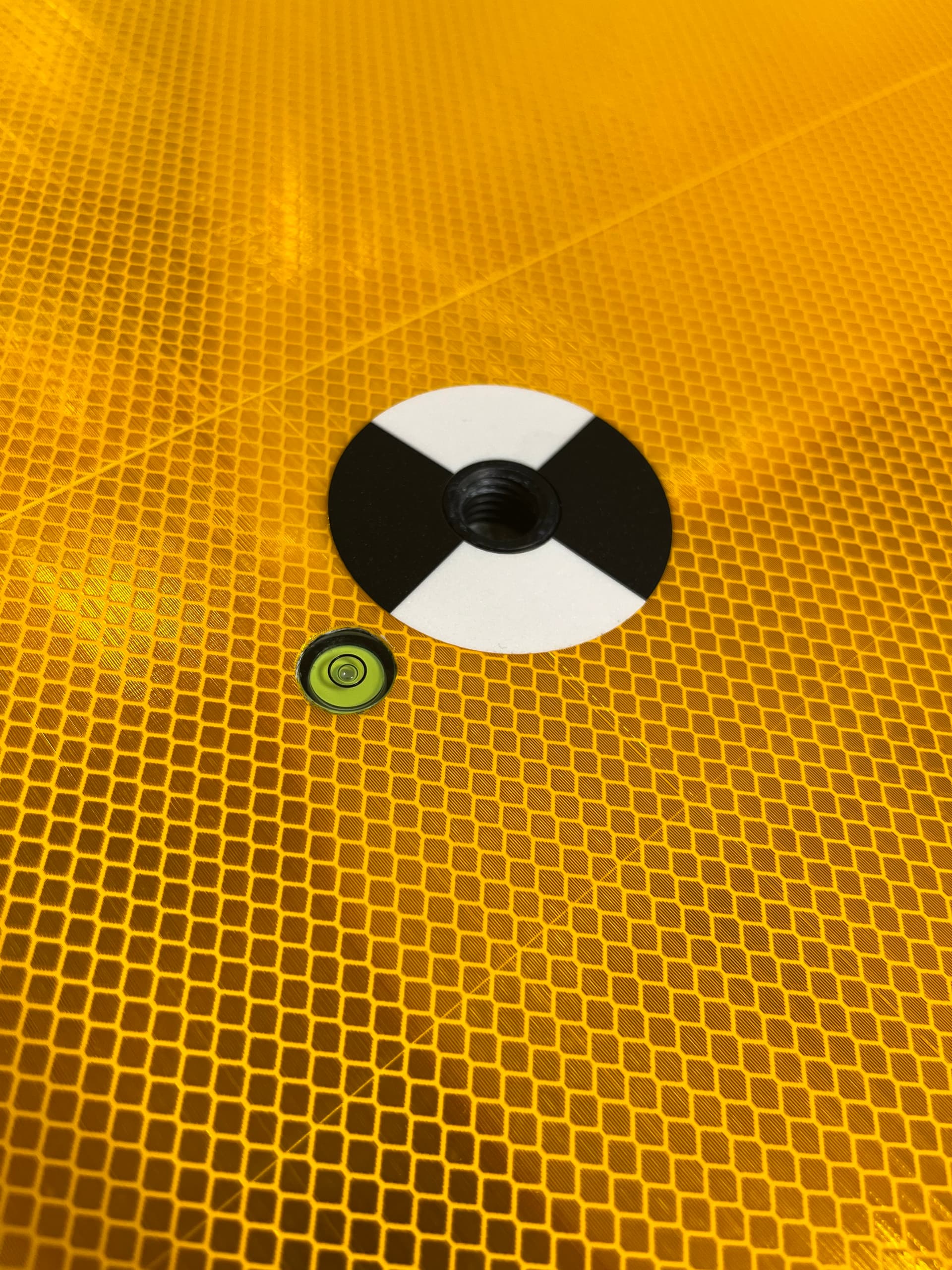
The targets work great, you will need to make sure they are level for more accurate returns. They are designed where you can put them on a tripod above the grass and then calculate the elevation distance and drop the point below it during processing. However, for my use case I place them on the ground level.
I ordered one without the tripods, just the target. I use that as my main target usually positioned center of the capture. Then I usually use two more custom targets that I made myself with similar material to check alignment and elevation at my highest and lowest parts of the capture. Depending on the mission plan I may add more targets. I fly in very flat area’s which simplifies it for me.