I have long been concerned about the visual methodology of manually boresighting the R2A and not performing strip alignment which is all part of the standard workflow of big airborne laser scanners. I have seen some random alignment issues creep into the data, particularly when working with higher altitudes (120-300m AGL) and when flying faster than 18m/s.
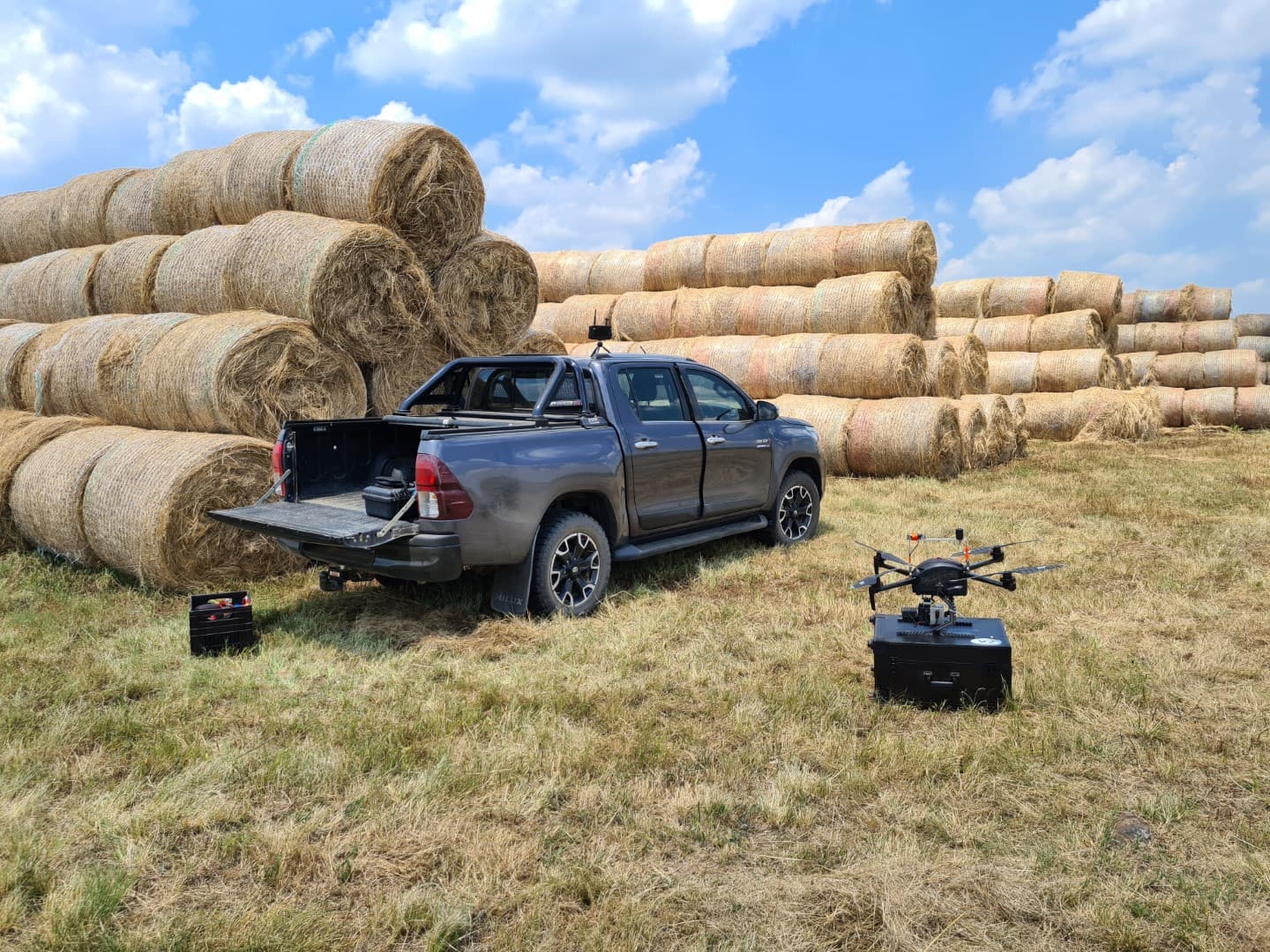
While the R2A is an excellent tool and the accompanying software perfect for raw data extraction, there is still room for improvement. I have spent the last few months collecting datasets and trying my hand out at various post processing software to try and locate some of the inaccuracies I find from time to time and iron them out.

I initially tested out StripAlign from BayesMap. This is a very nice piece for software but super complicated to work with. It is all CMD and not easy to get working with the current default outputs from PCMaster. Data has to be converted to GPS time, trajectories need to be edited to suit import formats, and then it is a nightmare to really get working. But it does a brilliant job once you have mastered it and is fairly quick to run. The cost too is also not bad. But its a pain.
The reporting from StripAlign is brilliant and very informative.
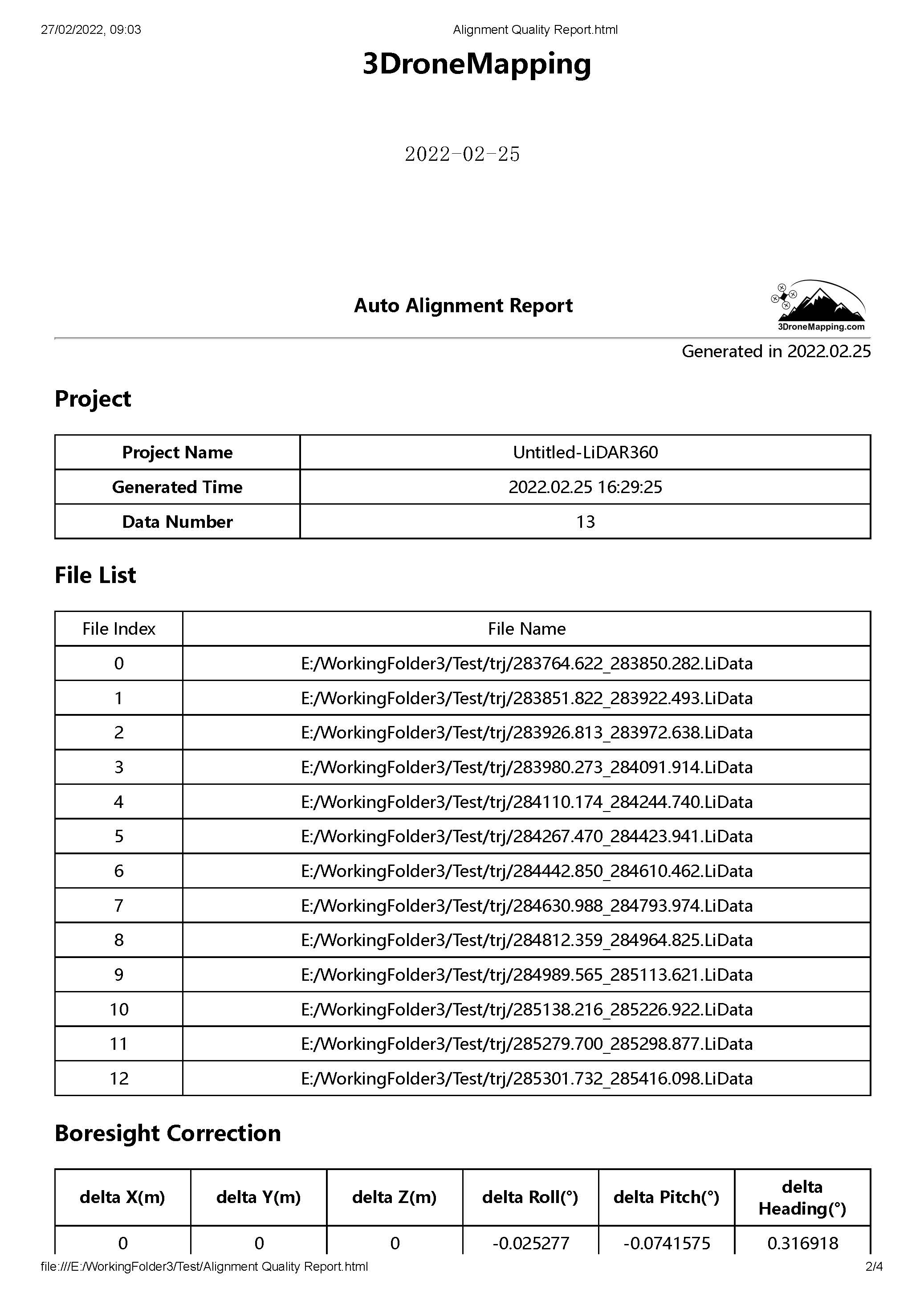
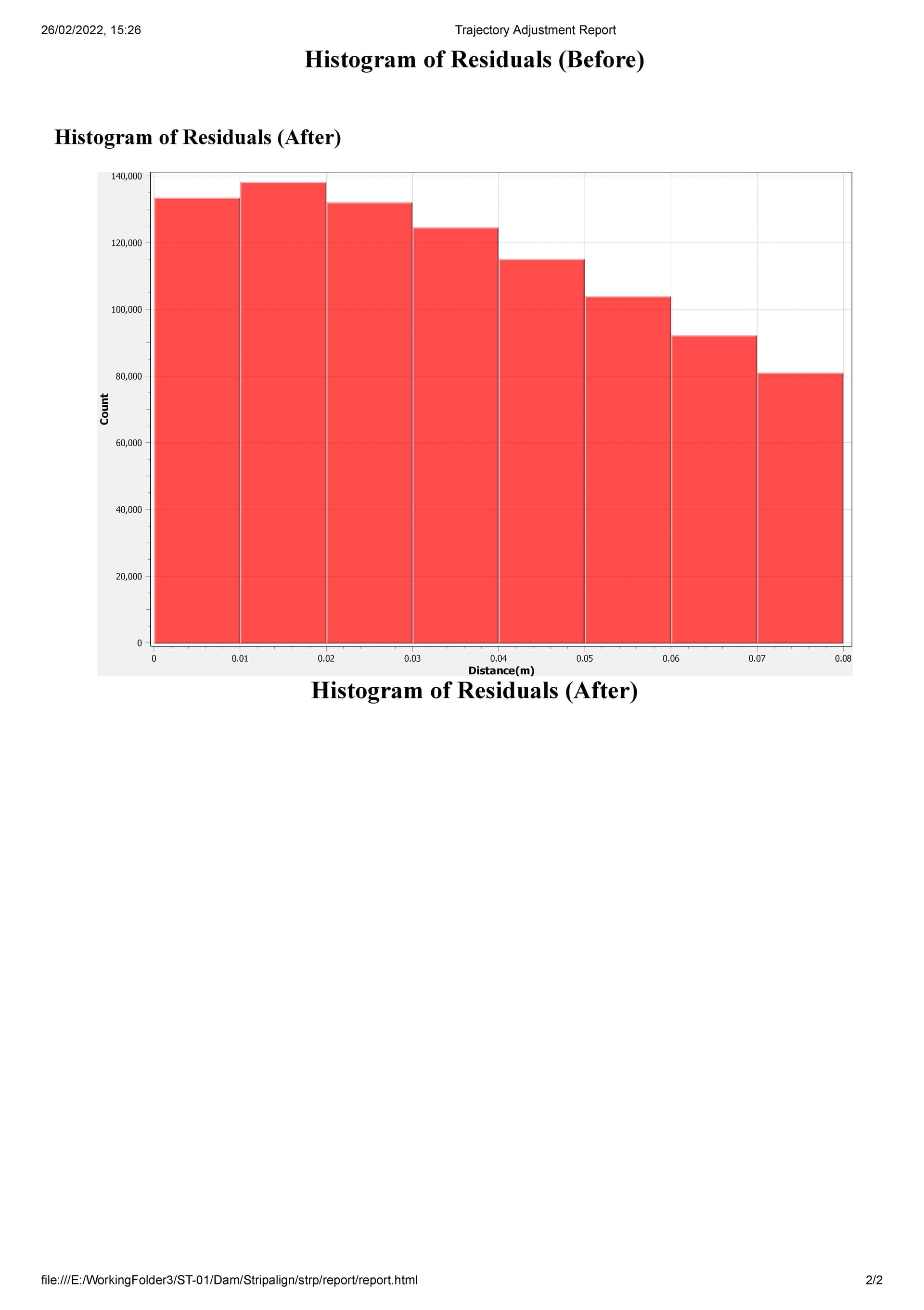
I already have used LiDAR360 from Green Valley for classification routines and height adjustments but struggled with the boresighting and strip alignment tools at first. Some of the tutorials I found online were older and not relevant to the current version of LiDAR360. But once I got it working, it was a pleasure to work with.
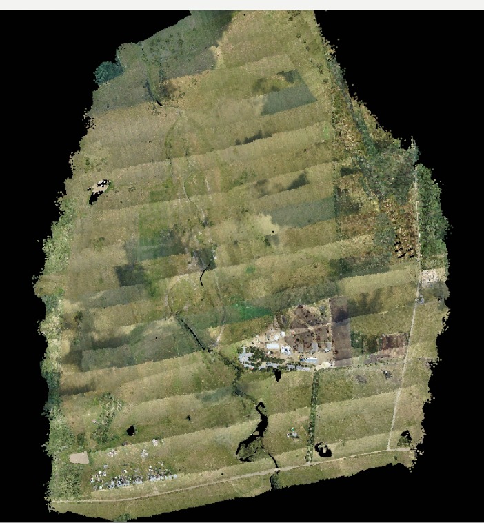
Using a dataset that was captured from 80m AGL and had some cross strips in it, I formed a calibration of the boresight and got some interesting values. While I knew my boresight was not perfect, this one had much more extreme values than the conservative ones I had chosen in PCMaster. I tested these values against other datasets and got good comparisons. Thus, a boresight calibration file for my R2A was saved for future use. A useful tool here is the option to remove/classify overlapping points which dramatically reduces file size and non-assigned points from the boresight such as those on the turns, etc.
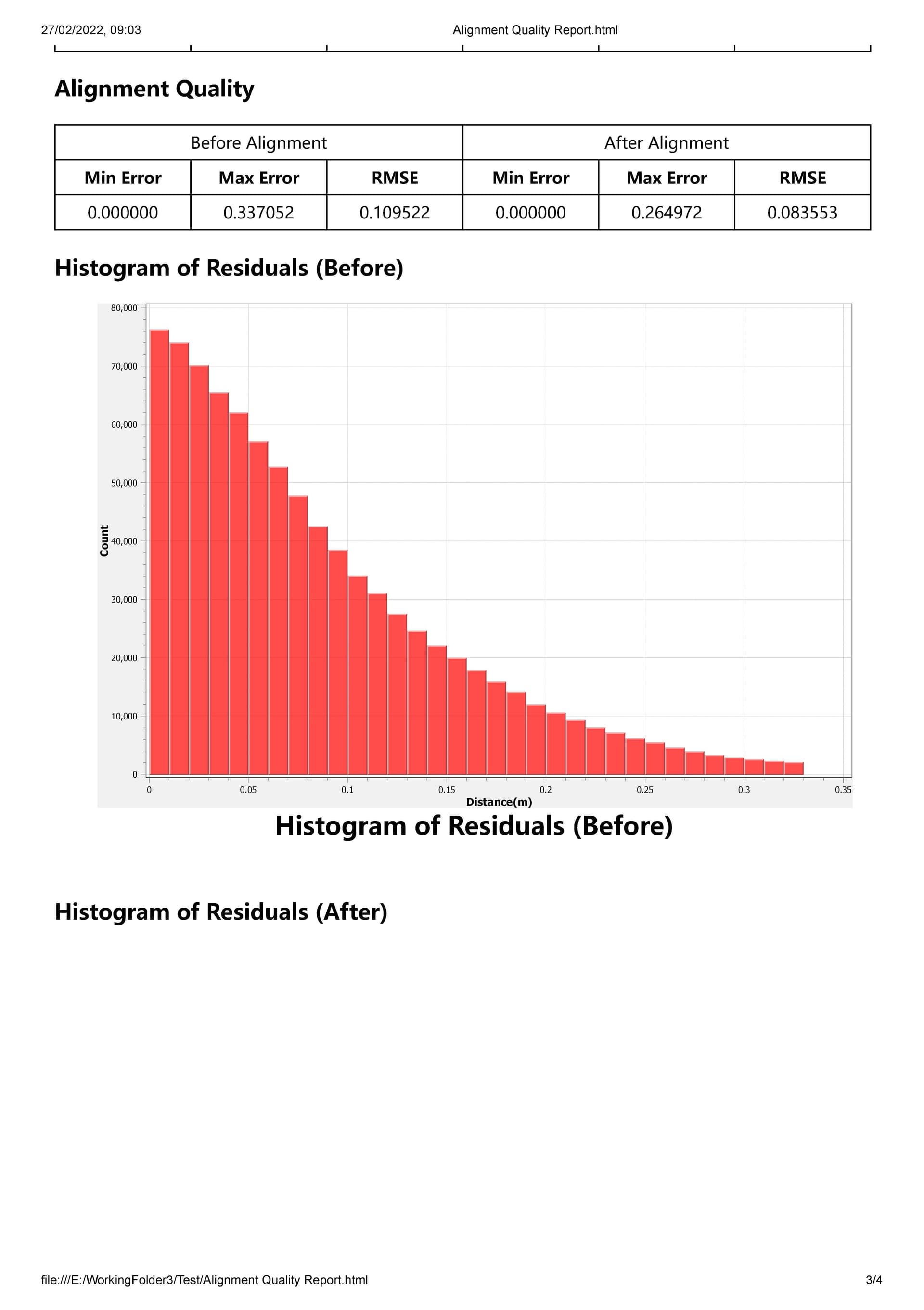
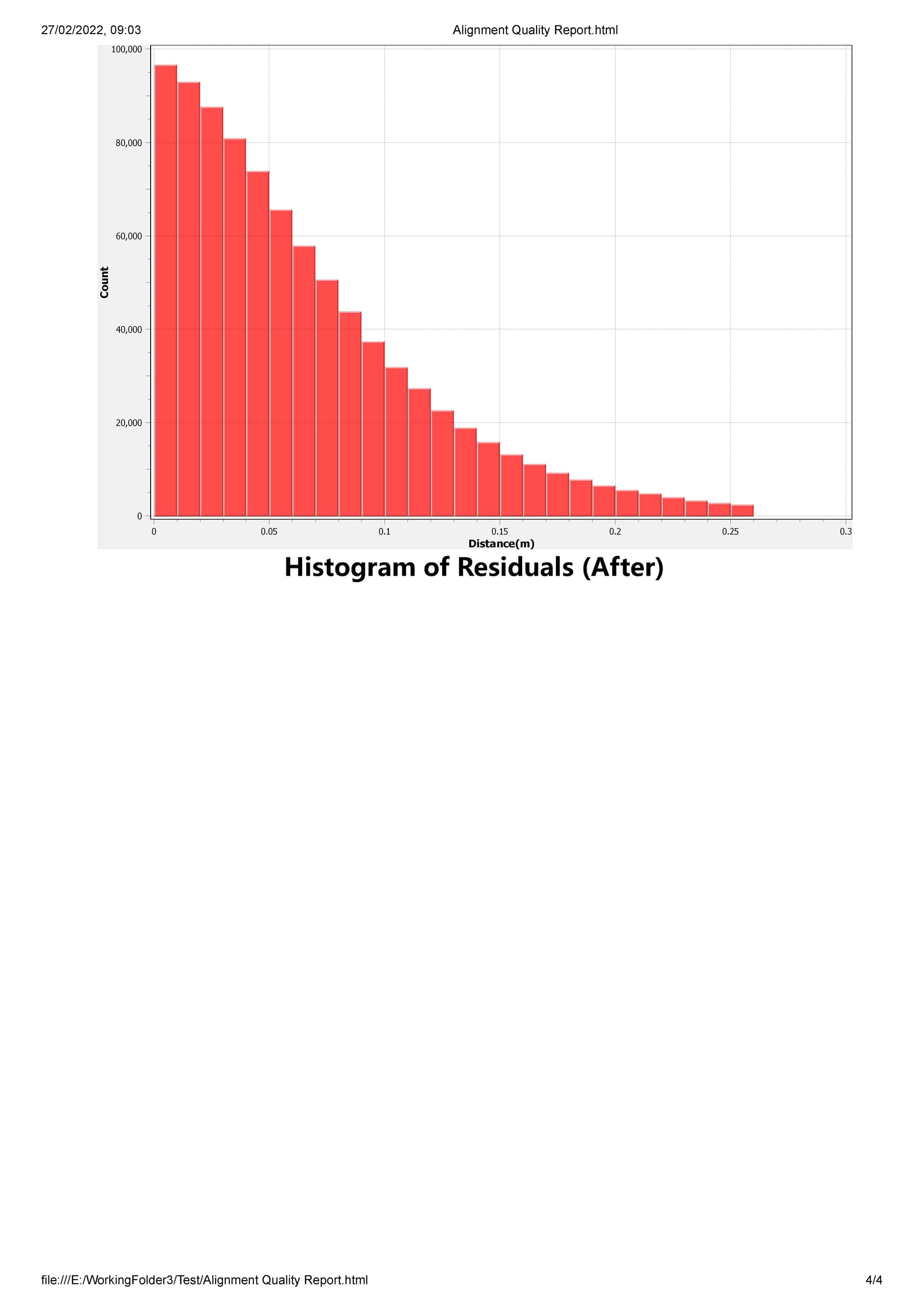
Later, strip alignment was performed on the corrected data. Here some surprising figures came out of the wash. I knew that there are some strips that suffered from drift, etc or poor angles of incidence, but the software clean this all up very well.

Having cleaned up data makes for much better classification and noise identification routines. My classification gave much more consistent results and filtered out non-ground points far more effectively.
While this is not a pre-requisite for small LiDAR owners, I do feel that post processing data further does allow you to get the very best out of your unit. These scanners are at their absolute limit and more crucially, the INS system is running at tolerances that are just at their limit of what is accurate in photogrammetry accuracy specifications. Having some clever software help clean up your data, align it and give a smoother, more representative record of the topography is really well worth it for commercial work.