Greetings LiDAR gods.
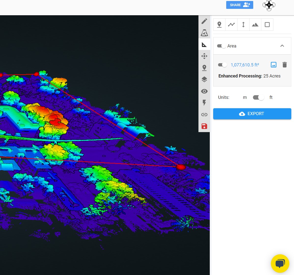
We can now choose what will be in the processed deliverables by utilizing the area tool to save tokens
I am having trouble understanding what to do after making the polygon.
-polygon around the area desired (great! 40 acres is now 25 acres)
-press image icon “enhanced processing” and then export(?)
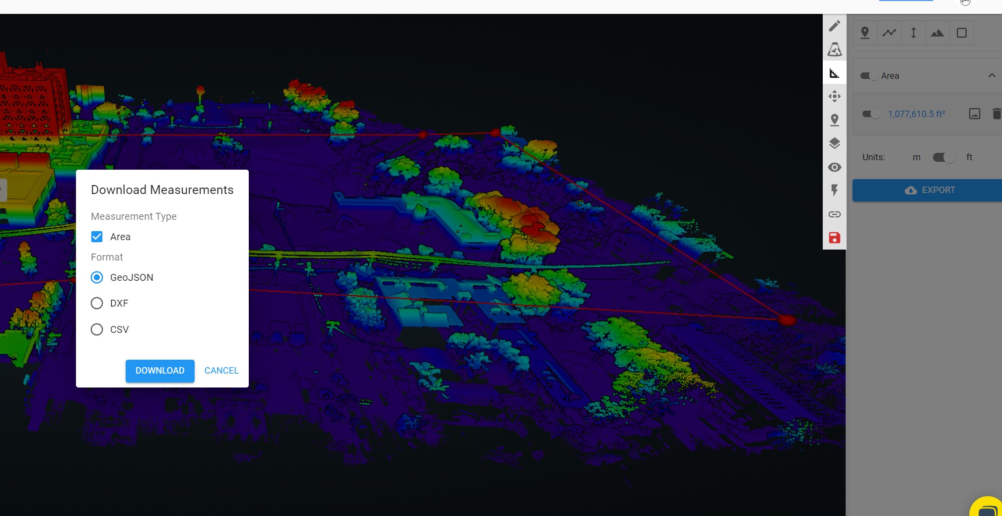
-popup appears with selection of downloads (what do I do with these?)
-Go to process and order rock surveyor and it still says 40 acres will be processed.
There must be a step I am missing and the FAQ article isn’t clear on that.
Thanks!