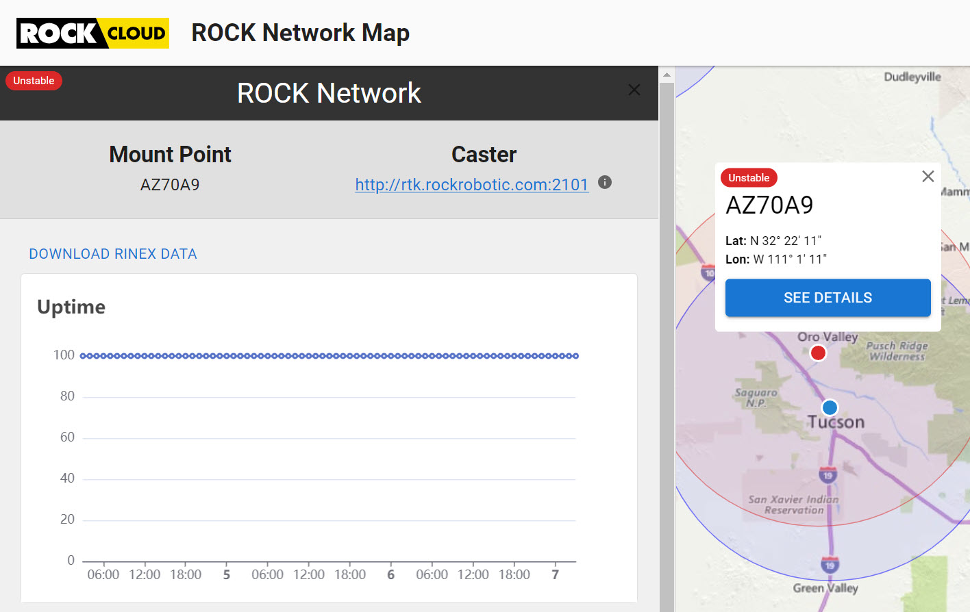
What are the criteria to determine the status of mount points on the ROCK Network Map?
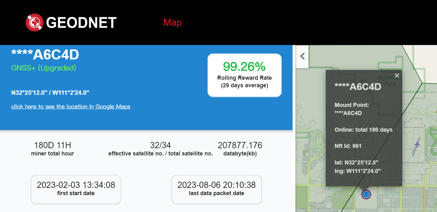
One of mine is showing as Unstable, but I do not see any indication of the condition, and the GEODnet map shows it green (99.26%).
What are the criteria to determine the status of mount points on the ROCK Network Map?
One of mine is showing as Unstable, but I do not see any indication of the condition, and the GEODnet map shows it green (99.26%).
@HawkView There are two real-time processes going on:
Quality of data
To be part of the broader Rock Network, we set a very high bar for data quality. In order to consistently be at that high bar, the antenna needs to have an unobstructed clear view of the sky. If there are any obstructions at all, then you are likely to trigger below the quality threshold. When dropping below the threshold the base will go into the “Unstable” status.
Movement detection
There is also a real-time algorithm running in order to detect movement of the base stations. If a movement is detected, then a base will become inactive as well.
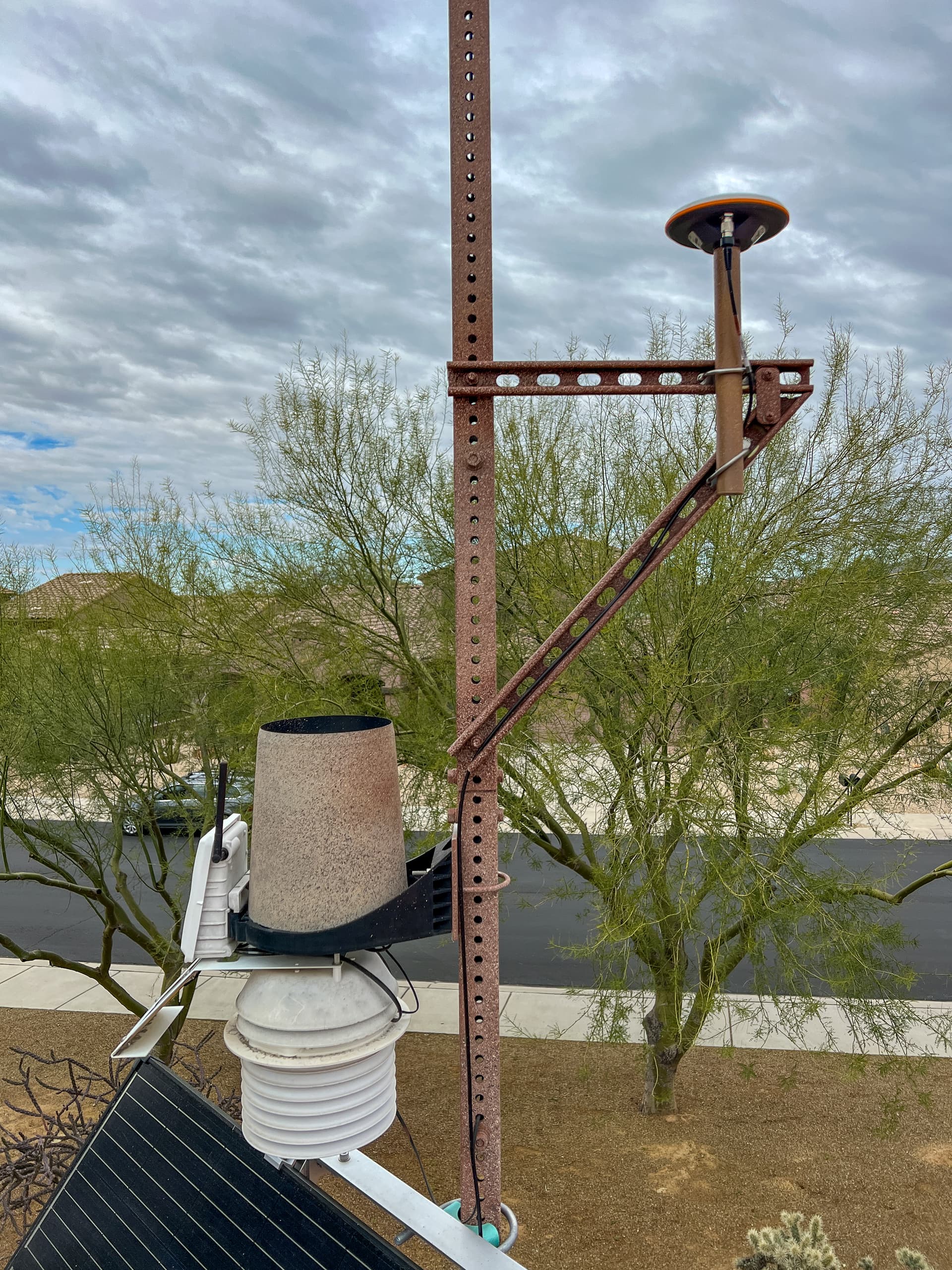
If you think this base has 100% clear view of the sky (above 10 degrees from the horizon) and it hasn’t moved, then let us know and we can check the base. Also, feel free to post a photo of the base location if there is any question as to the install.
@HawkView it also looks like you posted a screenshot of two different bases. Was that intentional?
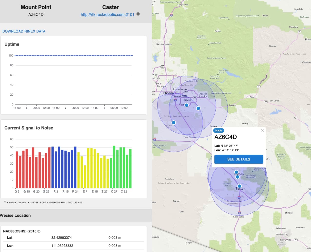
Those are my bases. The GeodNet map shows a base about 6km south of my home with the last four digits matching the digits in the ROCK Mount Point. Perhaps the mount point is incorrectly identified?
I have three bases:
Home E831CDFA6C4D AZ70A9
Office 30C6F7BD7845 AZ7845
not installed 30C6F7BDDFA5 -
These are two different bases. Let us see what is going on with E831CDFA6C4D