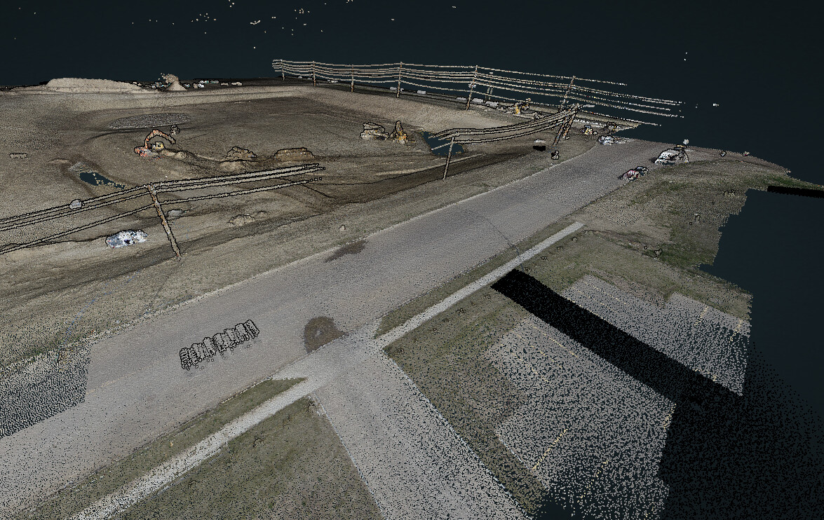
I post this here so we may learn something from a bad data set? I completed a flight of a storm pond last week that has power lines along the east and south ends of the job. As I am still learning the secrets of the R2A, which are not so hard when you follow the published guides, but this one has me confused!
Look at the southern power lines… and there is a large gap!! Everything else came out, mostly. The mission was flown at 60m AGL with 30% overlap (based on the suggested camera settings and using the not so great M300 mapping software) .
(Images look to the north) The southern power lines had at least 3 separate passes over the missing section. The larger power lines to the east are almost perfect, and this was only one pass directly on the alignment and some overlap from the passes building up to the power line. There is more road and power to the east of the those big lines, but that was caught in a side pass and not directly imaged! Which really leads me to wonder why only the south power line has a large missing gap. In the color photo, you can see the missing strip of data? How does that work? Where have I gone wrong?
Reference Lidar job#1185.
Thank you Rock Robotic (and community) for your assistance.