I had the opportunity to fly an interesting road with my lidar. Only ONE pass, north of 7m/s velocity.
I followed it along, adjusting my AGL accordingly, however, I am sure that my velocity was constantly changing…
It produced this:
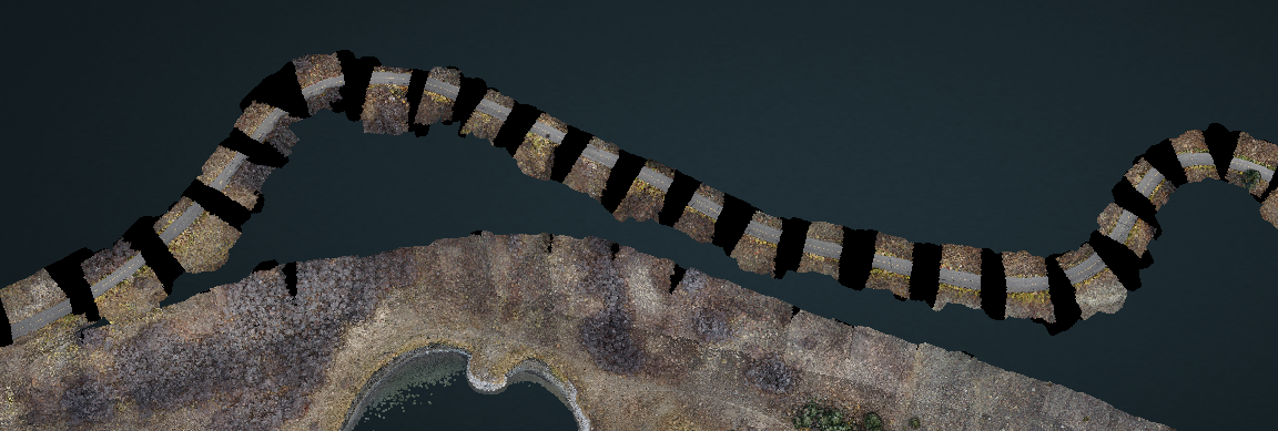
While the Lidar did it’s job, but the photos are spaced out like a bad zebra.
I am assuming it is because my velocity was greater than my camera timing?
Just curious to know, as I like to see explore my errors when I can to help refine my technique when I am flying by hand. I know I could have made a second or third pass, overlap and all that good stuff…
Thoughts?