How-To LiDAR SLAM: ROCK R3 Pro - YouTube Great new video!
1 Like
Hi Danial,
What is the status of RGB colorization of the point cloud with Slam? I am looking at using aerial and slam data to capture a subsea landing station being built from land development to building erection and headend equipment being placed. It’s a pretty cool project from a telecom and data center point of view. Anyway being able to apply the RGB view would be pretty beneficial indoors once the building is complete.
We are actively working on the RGB colorization of SLAM now. Q4 is the current projection.
With an upcoming project for NASA, I’m being asked to fly into a number of caves. The traditional LIDAR collection will not work as I will loose GNSS signal. If I flew the LIDAR, but selected SLAM mode, would I be able to basically fly SLAM?
@mike.elliott yes.
All the normal SLAM requirements persist. There need to be “features” that the SLAM algorithm can recognize. A “typical” cave will be no problem. But if this is a man-made cave that is completely smooth, SLAM may have issues.
Would this also work with the R3 pro flying under an oil rig to capture the ‘Belly Side’ of the rig?
I don’t see why it wouldn’t @Bill
What about georeferencing SLAM data? When will that be integrated in processing? Or will it be best to scan a georeferenced target similar to flying?
@wallsLANDwater
“When will that be integrated in processing?”
Today! New release to Rock Desktop is going out today. It includes a whole new alignment workflow for SLAM!
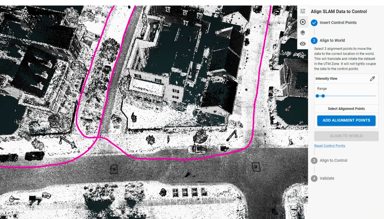
You can add a csv of GCPs and go through a step-by-step process of aligning your SLAM dataset. This will both georeference the SLAM data to the world AND correct for any drift that may occur over long data captures!
1 Like
This is great. Does this mean that now we can do SLAM processing without uploading data to Rock Cloud?
Yep, SLAM Processing is supported fully in ROCK Desktop and is the recommended approach. You can still use the cloud to upload the final result and merge it with other datasets.
1 Like