Ok, so you got some Ground Control points from a surveyor. And more often than not, the surveyor didn’t tell you what projection/state plane the coordinates. Somehow - he expected you to just know.
----well, I don’t.
So Here is my investigative approach.
Step 1 Just ask the surveyor
Now into the details.
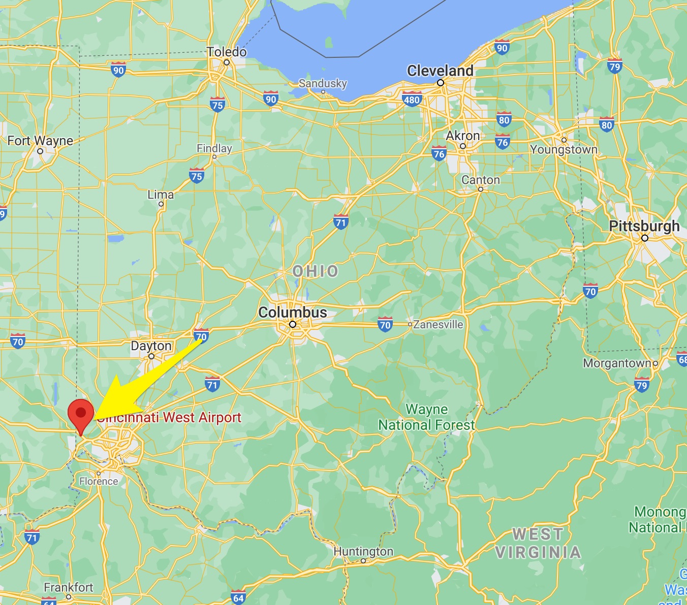
For this use case - I am using these 3 numbers from an excel sheet, and I know I was flying at the I67 airport near cincinnati. So these should line up
468724.848, 1325492.255, 561.588
Now lets figure out what projection these are in
FIRST, I am assuming you are in the USA and are using the state planes. So we will want to find out what state plane zone I am in. Here is a big map! But you will need to further google for your states map if you are close to a border.

From this map I can see Ohio has a OH N and OH S zones - Ohio North and Ohio South.
Clearly we are in the Ohio South zone. So Now I want to do a sanity check and verify that this is accurate.
Lets see if we can get these coordinates to show up on the map in the right location
So in my project, I uploaded my lidar data and then I am going to upload the GCP, BUT i will do it twice, since I do not know which is the X and which is the Y - So I will do it twice and transpose the X and Y and see if any lign up to my project area
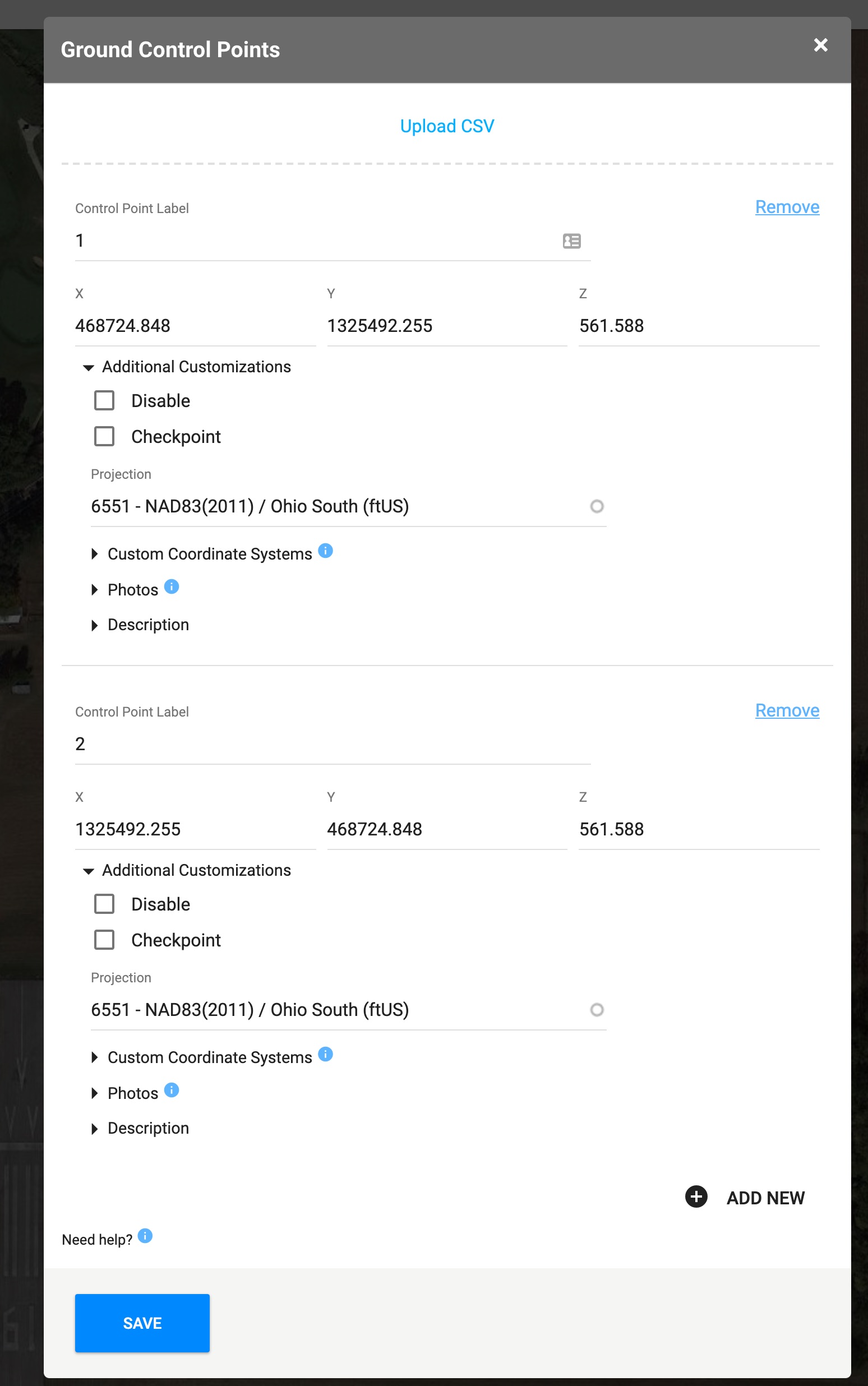
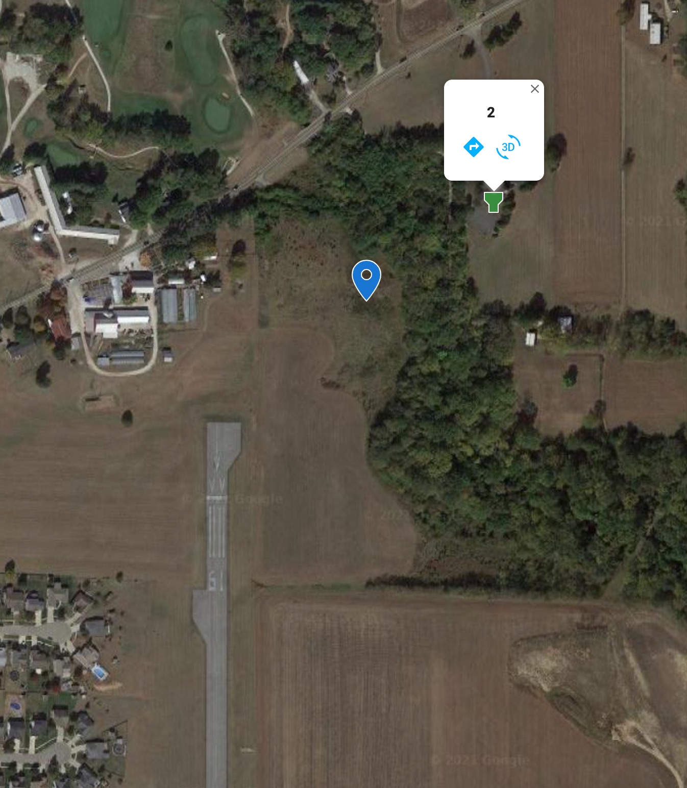
AND BOOM! That second one is right where I would expect it to be.
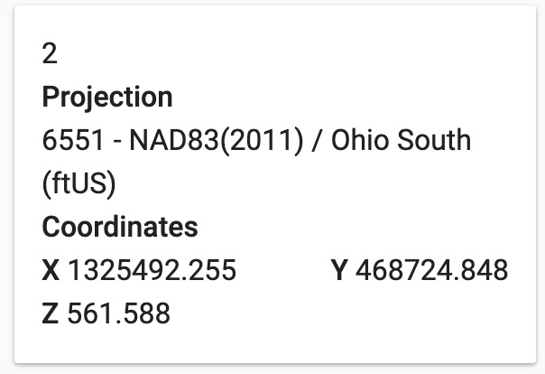
Now we have our answer - The GCP is in 6551 - NAD83(2011) / Ohio South (ftUS)
X =1325492.255 Y = 468724.848 Z =
561.588