A lot of my jobs in Texas I hear the surveyors or Civil Engineers talk about grid or ground coordinates being used.
What are most of you seeing/using and how are your getting the type of points and surface you need for your deliverables when the Rock cloud and Google maps and most drone based programs are built in grid format?
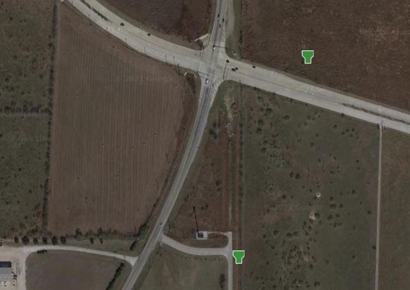
Take a look at the attached photo. You’ll see two GCP markers. One is the coordinates in grid format (looks proper on the basemap) and the one further northeast in Ground (surveyor wants his data in this format but it shows up too far north and east on the map). They are the same point, but with the ground calibration (combined scale factor for this location is: 0.999843167).
This is a great question. Right now we are working to offer a site coordinate option. This will enable the use of scale factor and false northing and false easting. Currently the cloud will output Amy EPSG code projections
I am curious what others are doing right now. @Daniel do you Have any suggestion?
We use grid to ground some - actually planning on it for my next r2a mission. When I get the points though it’s not two sets they always match- I’m guessing our surveyor processes them and sends me the correct points. I will ask him. A scale factor error in the DC could be a problem- it’s happened to on of our crews and we had to do a survey over. That might not be what’s going on here though. Typically I use true state plane coordinates for our GCP (from the traverse) and I also use just regular shots after the data is reduced. It’s possible to use just GPS but you can get some float if a .1 or .2 on the z you need to account for by using a lot of points
Typically, all of our survey project data is delivered in a State Plane projection with the appropriate surface factor applied. I prefer to work in grid with Lidar data as most derived data can be scaled to surface (ground) within most CAD applications. The most important thing to remember when delivering data is accurate metadata indicating whether its in grid or surface, and what scale factor was used if in surface.
Yep @park, @Daniel same here… @JarvisW just be ABSOLUTELY clear in the meta data what you are importing/exporting and let other software do the conversion / projection for now.
Though I can hardly wait to do this directly in RockCLOUD, just as a safety check against human error.