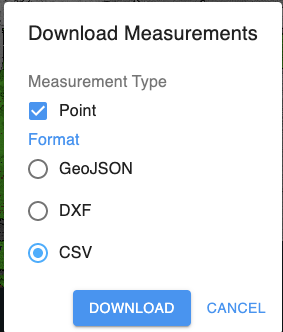
So the question is, when you produce points from “add points” in the cloud. You can export those points as a DXF or GEO JSON which I have never played with. The DXF file has no GEO data with it. Could someone explain GEO JSON to me or could we just export the “added points” as a txt file of some kind.
Export as a dxf, when you bring them into a drawing you will have to convert autocad points to Civil3d points. Kinda of a pain, but as of now its the only way I have found to get them in.
OK, thanks. When I brought them in to Civil3d it was just a small circle. So I just made points based on the surface i built, but i will try your way next time.
Yeah, whatever order you want to put it in. PNEZD or something like that. We have used that feature a few times now versus GPS data in the field. Tree lines, edge of road it just handy to save a trip.
BTW, outstanding job on reacting to this service. Clients love being able to see a project without needing a program to view it.