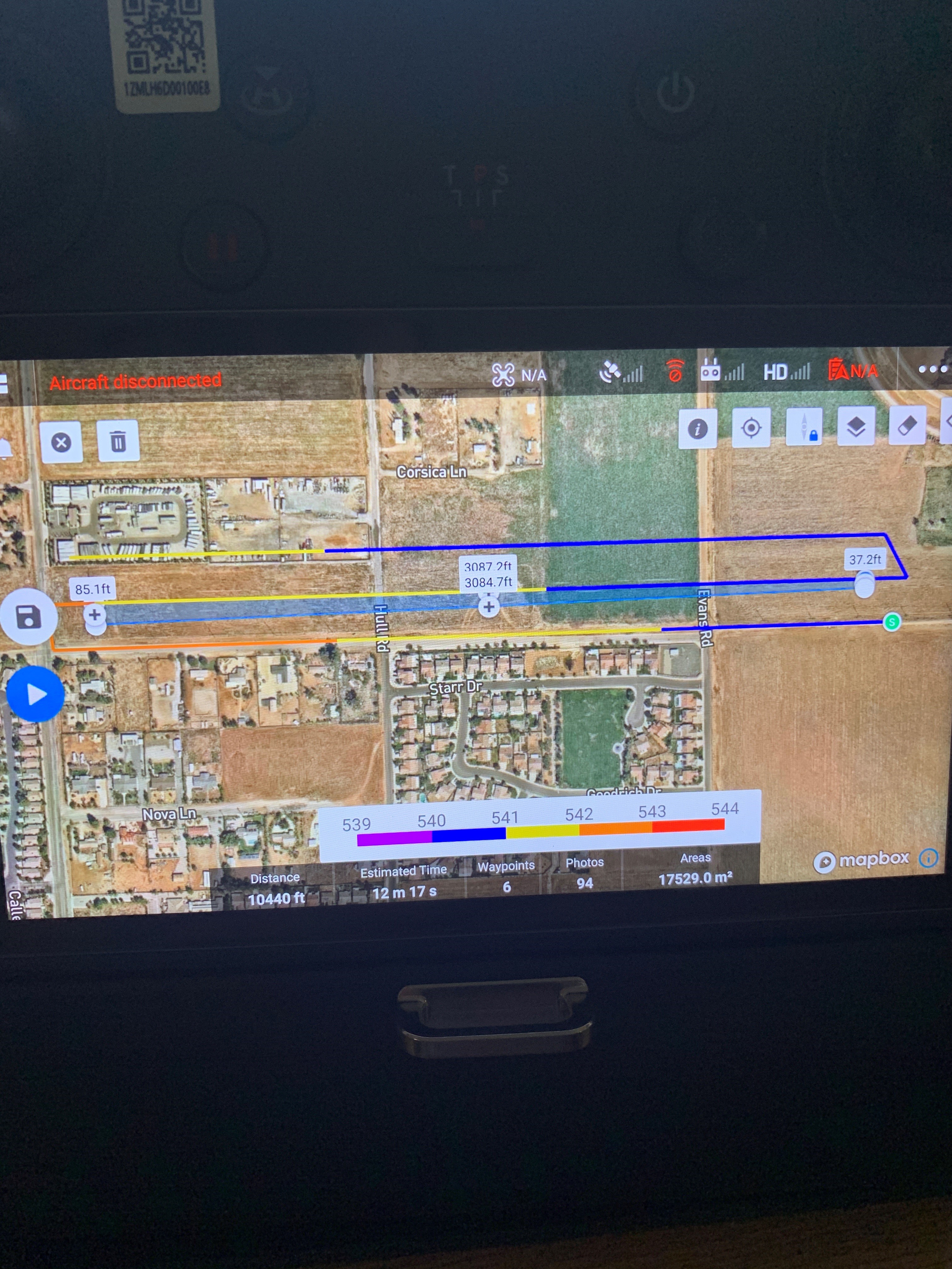
Hey everyone, recently I have been trying to import the Digital Elevation Models (DEM) into the M300 mission planning software in order to have terrain following/adjusting enabled to allow for more accurate distance of flying over transmission powerlines over long distances. I was successful in uploading the DEM file into the controller and it recognizing the terrain changes. However, when I went out to fly the drone and practice mapping with our R2A I wasn’t getting the desired results. I would fly up to my height of 300ft which was preplanned for the mission and then would start the mission in the app. When I would go to start I was getting an error that the drone was too high from the designated mission height even though I would start slightly below the designated height. I have attached a screenshot of the controller, maybe someone here can see if I have something messed up? Appreciate any help or feedback!
So we have been using UGCS with great success. We have flown several Powerlines using the terrain data imbedded in their software. We are able to view the planned mission elevation pre flight and can see if there are any red flags as far as terrain. May give this a shot. Not sure what program you are running.
@ncarr99 We have had varying degrees of success with DJI Pilot mission planning, but it is not as smooth as one would hope. Perhaps you need to upload the mission while the M300 is on the ground and hopefully you won’t have the altitude issue that you mentioned. Here are a couple of other considerations for DJI Pilot Mission Planner and the R2A:
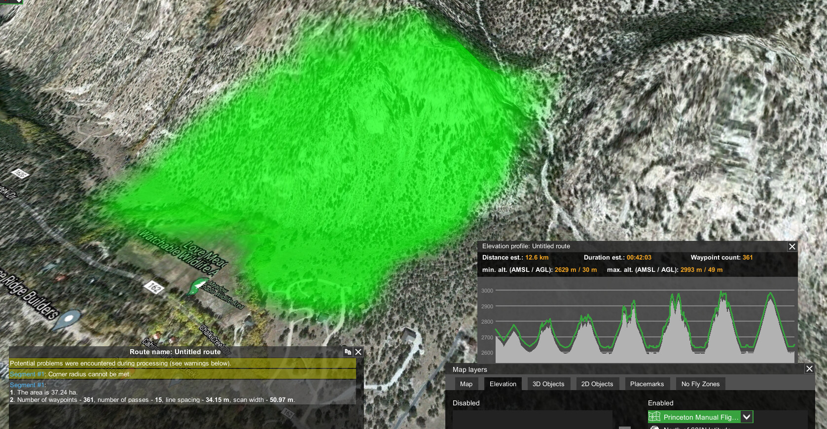
- The DEM files for Pilot have to be GeoTIFF files which can be downloaded from USGS here https://apps.nationalmap.gov/downloader/#/
- You want to complete all of your mission planning and parameters before you import the DEM as it can potentially slow your smart controller to a snails pace.
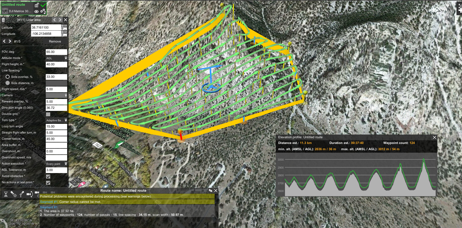
- You can create a custom camera for the R2A inside DJI Pilot and use these settings:
Width = 6000 px
Height = 4000 px
Sensor Size (Width) = 23.5 mm
Sensor Size (Height) = 15.6 mm
Focal Length = 18 mm - The margin needs to be set to 0% as it already extends pretty far outside of the selected AIO (Area of Interest)
- Forward Overlap can also be set as low as possible (I think 10% is the minimum)
- Side overlap should be set to 50% or less it really depends on the AGL of your flight.
@Lgeren You’ve had some solid results out of UgCS flying power lines. Would you have any interest in outlining your steps for others to follow? It is a very powerful piece of software, but it certainly comes with a steep learning curve! I’m sure others would benefit from your knowledge and experience.
@ncarr99 Reading your post about getting the DEM from USGS. You’ve indicated its best to set all the mission parameters before importing tiff into the smart controller. What exactly doing you mean by setting the polygon? How would you create your grid flights outside of Pilot?
Thanks

Are the camera setting you specified above for R2A and the DJI Pilot app the same when setting it up with UgCS?