We have the opportunity to scan the “Reesor Lake” Day Use dock, in the majestic Cypress Hills, Alberta.(N49°39’56"; W110°06’14")
However, because the lake is high in the hills, there is NO cellular coverage, hence, there is no signal (OPUS) from the correction station. Currently, we are not aware of existing monuments or references in the coulee where the lake is.
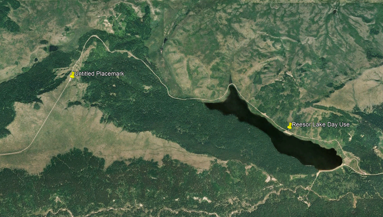
However, about 3,100 l.m away, and about 150m higher (N49°40’19"; W110°08’50") than the subject scan area, is the most ultimate lookout point EVER. You can literally see, on a good day, the bend in the earth from this vantage point! So, if we put our base station up here, and scan the dock way down there, will the data quality suffer?
We may be able to place a known point down at the Day Use area, or occupy a point, but it would only be relative?
Suggestions? Advice?
Thanks!