As I play with my models in the Rock Cloud, I discovered a tool called “clipping”. It works almost identical to the Bentley Microstation tool of the same name/function.
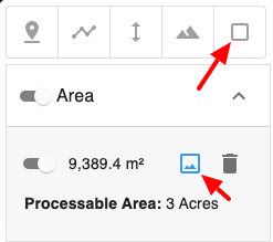
So I clip out only the area I am interested in. Let’s say that is 9 acres inside an 18 acre lot. Only the clipped 9 acres is visible. Here is my question:
- If I “save” only the clipped area, does the rest of the point cloud simple vanish?
- If I decide to manipulate only the clipped area (the 9 acres in this example), it makes visualizing on my computer easier… so if I adjust the x,y,z of the clipped area, does the invisible portion of the point cloud also adjust?
- Its a frugal time and I don’t want to process the whole 18 acres (2 tokens), only the 9 acres I want. After I clip it, will it only apply the deliverable to the 9 acres?
There are so many fun things to do with this data!