I usually use photogrammetry for building elevation ortho photos & point clouds to enable CAD drawings of the building elevations to be created.
Would this be possible with lidar with the r3 pro v2? I think we would need to adapt the data capture to suit, so looking for some advice given the laser will be emitting to the sides and down (not to the front) of the unit.
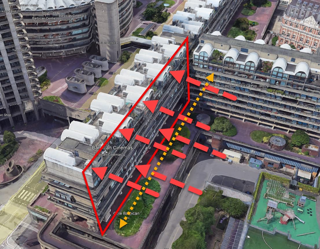
Here is a typical building:
We want to capture the area highlighted in the red polygon.
I was looking for some feedback on the approach here:
We would start at ground level, fly parallel to the building facade, with the drone flying in the direction of the yellow arrow.
This would mean that one side of the r3 pro would be facing in direction of the red arrows, towards the face of the building.
The drone would climb at the end of each pass to enable full coverage of the elevation of the building? So basically a traditional mapping pattern but vertically. This can be acheived with UGCS.
With this method, colorisation may not be possible as the rgb camera is facing the ground?
We could also do a regular flight above the building.
Have you seen r3 pro be used in this way previously? It could save considerable time over the standard photogrammetric method.
We could also do a slam capture at ground level and merge the two datasets together.
Has anyone else used the r3 pro in this way?