I flew 105 acres today.
My M300 was flying at full ability, as the wind was 12m/s at 60m AGL!!
We did get the whole survey.
Everything was super awesome until I got home. The gps base station file got deleted by accident (its gone and its mostly my fault) and I am unable to recover it. I am very stomach sick…
So I processed my data using “RTK”. Why not, right?
RTK isn’t going to help you as it is simply used for data capture verification in the field. Without trajectory correction you will end up with vertical separations and data inconsistencies across the board. You really need a RINEX source.
I was able to access our “CORS” station raw data. I ordered the recording for the time period I needed. I took the CORS data and processed it. The resulting data set is as you described… vertical separations and inconsistencies.
But why would I get that if I processed my data with PPK using the CORS?
I re-flew the mission, but I still want to know. I have a feeling this won’t be the last time we loose base station data in the field.
Thank you for this…
I did download the “CORS” data from the “base”, which was approx. 38.5km away.
I checked my processing report from the “bad data” against the known “good data”.
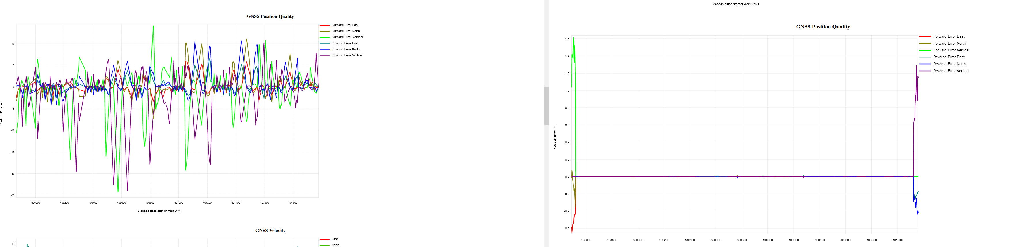
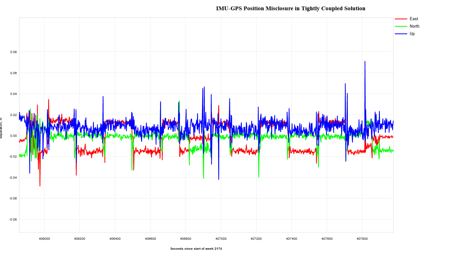
The CORS base was simply too far away. I can see that the software could not really resolve the lever arm and my IMU-GPS misclosure was in METERS!!
I looked at the quality of the GNSS position data received from Can-net, and it is all over! What’s the oldest saying in our line of work??? Garbage in, garbage out?
I’m going to run this data into the Rock Cloud to see what differences I get between CORS and local base station.
While I have a complete and nicer data set from the CORS, the error in the report is still quite large compared to the local base station set up.


 anyways… but if there is a way to fix this, I’m interested!