With the workflow around submitting your base station information to opus, there was a clause to add 2 meters to the antenna height (depending on what staff you use). I found that you can also just add antenna height as a parameter in the logging settings (see attached). If you set the 2m antenna height here in the reachview3 app, then you would not need to add 2 meters in the opus solution, correct?
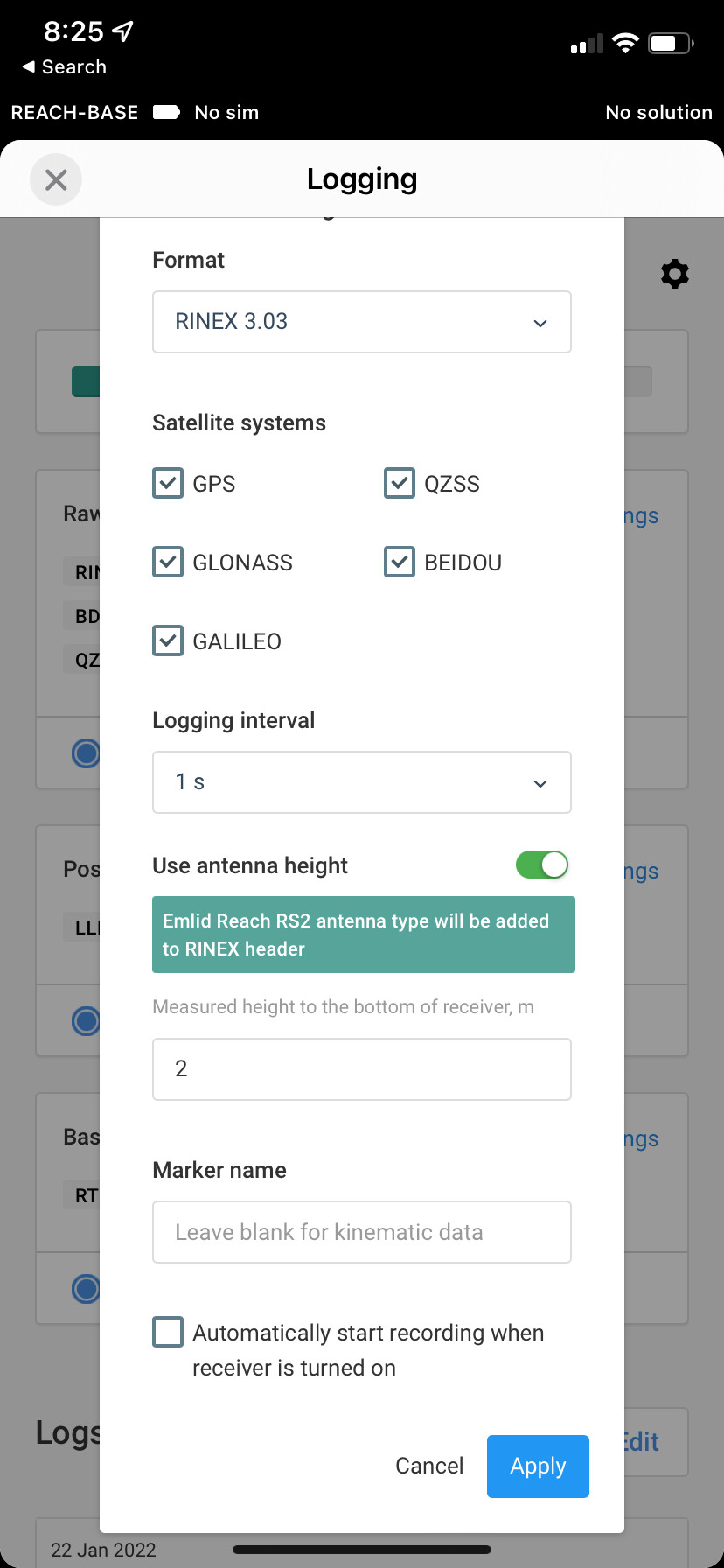
The ARP is contained in the .xml of your RINEX file I believe, as is the adjustment for your actual antenna (.134mm for an RS2) when you select it as your antenna in OPUS. I have always still put the 2m pole height in even if I have applied that in the ReachView 3 Log settings. I am not convinced that it matters either way.
It certainly could be worth an AB comparison if you want though.
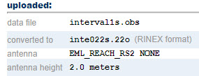
I just checked and had the setting you see there for the base station and I also ran the opus solution with the 2meters for antenna height. The opus solution results were used in the preprocessing desktop software for the lidar.
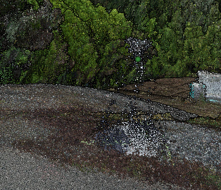
Im not sure if this is normal, but the GCP from the base station hovers over the actual ground about 2 meters. If I move the lidar dataset up 2 meters, then it looks like it matches up to the GCP. Im just confused if there is something I am doing wrong or if theres a setting im missing
I personally wouldn’t add pole height the Emlid interface. It really confuses things when using OPUS. Take a look here Using OPUS to compute a precise point with the EMLID Reach RS2 for PCMaster for all the instructions. But, pay extra attention to:
This is likely the issue you’re seeing.
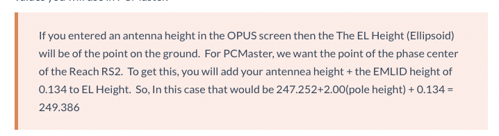
Thank you for the explanation. I have a question for that example. lets just say there was no additional antenna height added in the reachview3 app. in that case, is the 247.252 EL HGT the actual point on the ground? and then the corrected 249.386 meters is the phase center of the reach RS2?