The ROCK robotic crew just got back from a two week mission flying the Freefly Alta X with the Phoenix Ranger in Alaska. We will be posting lots of content from the mission. I will use this thread to document some field notes from the missions.
BACKGROUND
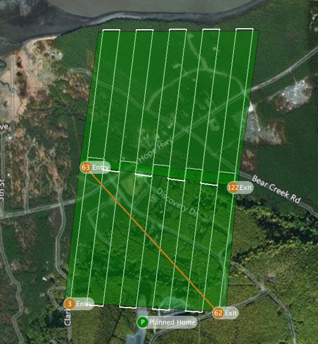
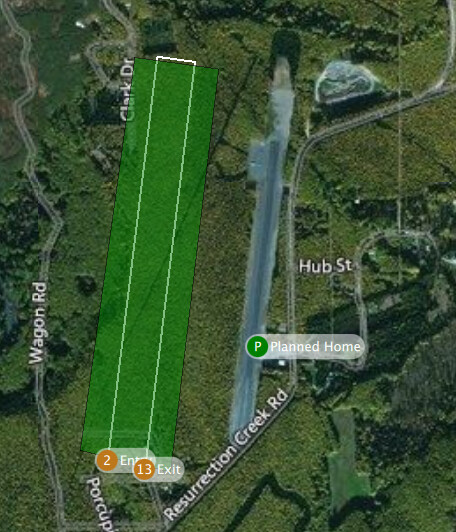
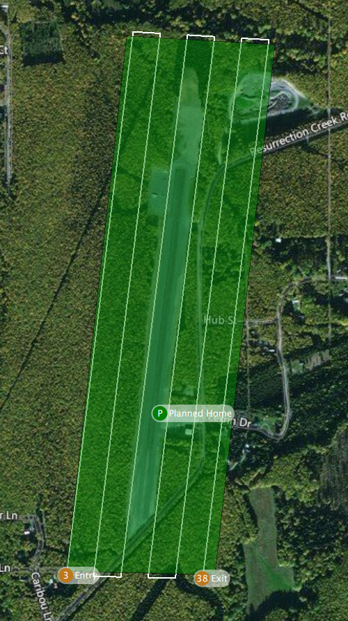
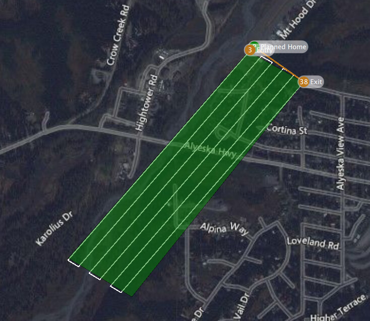
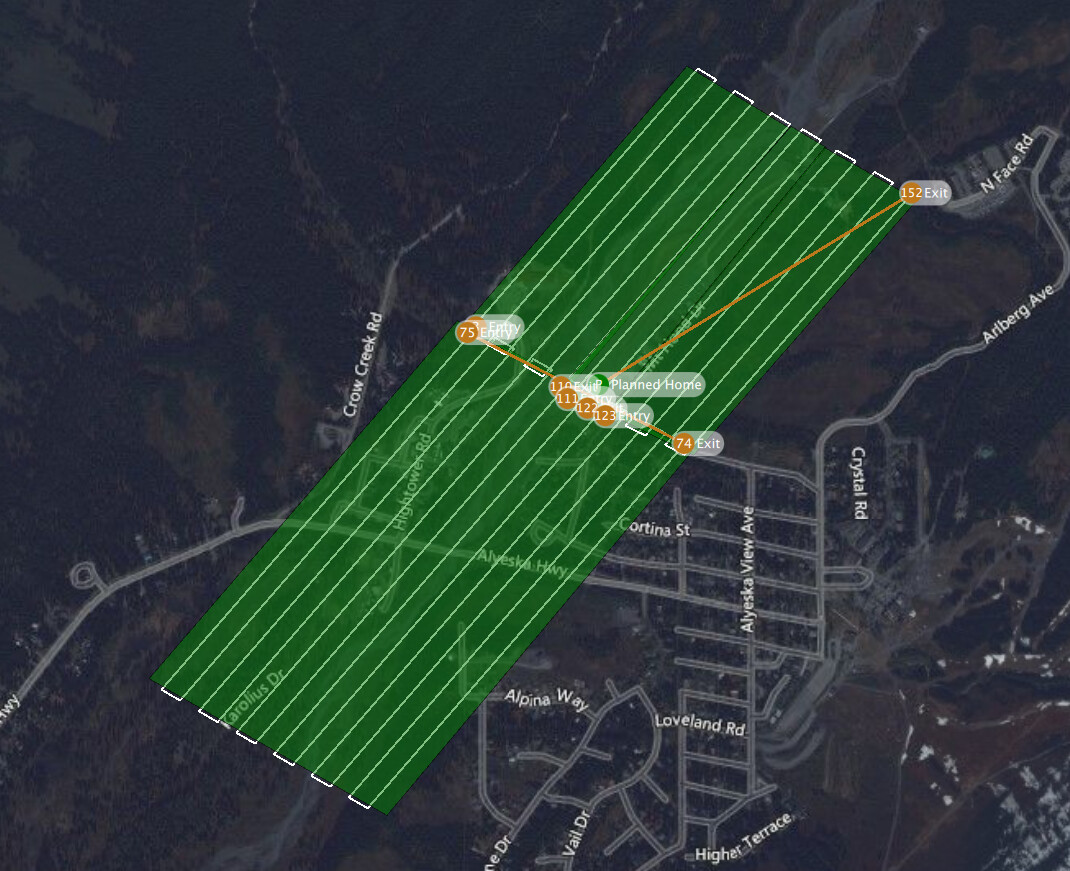
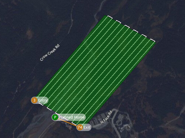
ROCK robotic flew two 700+ acre mapping missions in mountainous Alaska. The goal was to map Alaskan airports. The first airport took 3 solid days of flying. The second airport took two days.
FIELD NOTES
Q Ground Control
- There is no elevation data for Alaska. This made mission planning substantially more difficult and time consuming. Because there is no elevation data, there is no one-click button to do terrain following.
- Creating a manual mission plan where you go from point to point does not allow you to transition between the two points using a slope for the elevation. The way it works is the Alta X will navigate to point 1 at the correct point in space (x, y, z). Once it hits point one and starts to transition to point 2 it will first navigate to the altitude of point 2 before proceeding towards the point. Imagine if point 2 is 100 meters lower than point 1… The drone navigates to point 1, then before moving forward the drone lowers itself by 100 meters. If you are only at 60 meters AGL at point 1, the software will crash you directly into the ground directly above point 1. This is a problem.
- Manually creating a mission without terrain following and without attempting to raise and lower each point of the mission to the contours of the earth works very well. You are able to start, stop, and resume the mission with only minor issues.
- Another minor issue – At unpredictable times when resuming a mission the AGL for the mission will revert to a previous version of the mission. This occurred for us on numerous occasions where we updated the mission plan to raise the AGL for several legs, uploaded the mission to the Alta X, only for the mission to attempt to proceed at the previous AGL.
- QGroundControl very rarely lost signal from the Alta X. When it did, it was only for a very short period of time ~3-5 seconds.
Freefly Alta X
- The Alta X is a beast. It can lift and fly heavy payloads for a decent amount of time and is nimble in the air for how large it is.
- We flew right at max weight of 55 LBS and we were comfortable with about 8-12 minute flight time.
- The Futaba 14SG controller which came with the package would lose signal quite frequently.
Flight Time Logs
| Flight | Duration | Landing % |
|---|---|---|
| 1 | 10:40 | 32% |
| 2 | 11:30 | 38% |
| 3 | 12:21 | 33% |
| 4 | 11:35 | 34% |
| 5 | 8:07 | 45% |
| 6 | 11:58 | 35% |
| 7 | 8:29 | 46% |
| 8 | 7:20 | 48% |
| 9 | 7:35 | 50% |
| 10 | 8:35 | 45% |
| 11 | 8:47 | 46% |
| 12 | 8:40 | 47% |
| 13 | 9:08 | 45% |
| 14 | 11:05 | 45% |
| 15 | 10:21 | 45% |
| 16 | 10:01 | 43% |
| 17 | 9:51 | 38% |
| 18 | 10:48 | 37% |
| 19 | 10:25 | 41% |
| 20 | 10:17 | 42% |
| 21 | 11:21 | 36% |
| 22 | 11:13 | 37% |
Flight Plans