I have a large project coming and it will take to much time to upload to Rock Cloud for further processing so i’m planning to process in Terrascan or Lidar360.
Is anyone using Lidar 360 with R3 Pro data rather than going through Rock Cloud?
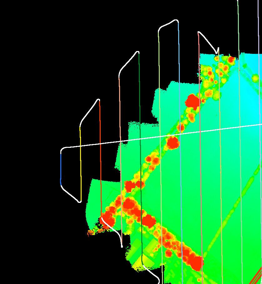
I’m running into issues with trajectories being slightly offset from where they are in rock desktop.
It could be a CRS issue.
If anyone has any tips for processing R3Pro data in L360, that would be great! 
Thanks
Jason
Anyone using Terrasolid / Terrascan?
Looking for help on importing trajectories.
Following up on this.
I have successfully imported into both Lidar360 and TerraSolid (terrascan).
The trick is to NOT reproject the point cloud or trajectories on initial import, this is what causes them not to align.
Also, trajectories are being detected as EPSG 4326 not as the UTM EPSG as suggested by Rock documentation.
So for example, I am in the UK, EPSG 32630 WGS84 UTM Zone 30N which means the point cloud will be in EPSG 32630.
- Import the point cloud as EPSG 32630 and do not reproject
- Import the trajectory as EPSG 4326 WGS 84 Longitude and Latitude
- Match trajectories, cut overlap etc
- Reproject point cloud into your chosen epsg and continue as normal.
When uploading to rock cloud, you set the uploaded data crs as the crs you reprojected to, so in my case, it will now be in OSGB36 (EPSG 27700).
Do not set a reprojection in Rock cloud, it is no longer required.
1 Like