Kevin N. Murphy - Nice to meet you all

Howdy :wave: :grinning_face_with_smiling_eyes:

I’m Kevin N. Murphy and I’m really excited to be diving into LiDAR and UAV systems. Day-to-day I work as a cloud infrastructure consultant for media production with AWS. I have about 6 years of experience in regulated cloud workloads and cybersecurity. About 13 years in media production. Been flying small DJI stuff for a few years but starting down the commercial path looking to eventually do topographical mapping and even further on bringing that into some 3D engines for media production workflows.

I love the Indiana Drones videos and Rock Robotic’s whole take on things seems incredibly open and transparent compared to most of the info I’ve read in the past few weeks. Thanks so much for sharing what you know Harrison (and others!) I look forward to learning from you all.

You can message me or setup a meeting with me to chat on my website at https://kevinnmurphy.com/#contact or feel free to hit me up at kevin@kevinnmurphy.com

Cheers!

Welcome to the community! May all your LiDAR dreams come true!

1 Like

Thanks so much! I have learned a ton from you already. Really appreciate what you are building :raised_hands:

1 Like

@knmurphy tell me more about 3D modeling with point clouds… it’s an area of extreme interest to me.

1 Like

@RR_Flight_Ops :wave:

So glad you are interested in this also! Happy to share the little bit I know at this point :slight_smile:

I haven’t experimented myself to great length but I have been able to open up some point cloud files in Unreal Engine (4.26/4.27 preview 2). I used some data from Chad at Fabre Engineering Wright Park, Lakewood CO | Rock Robotic Cloud


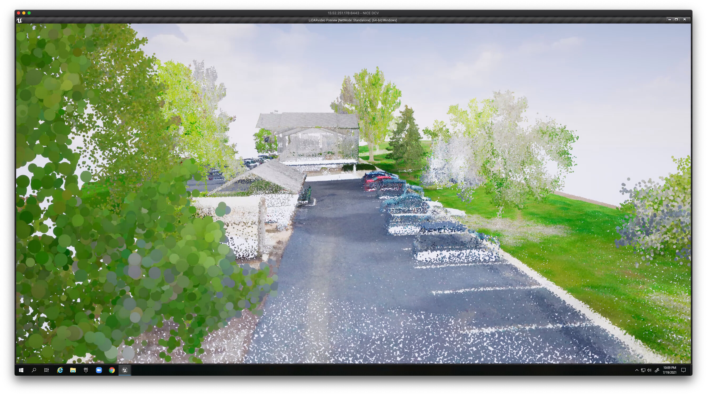
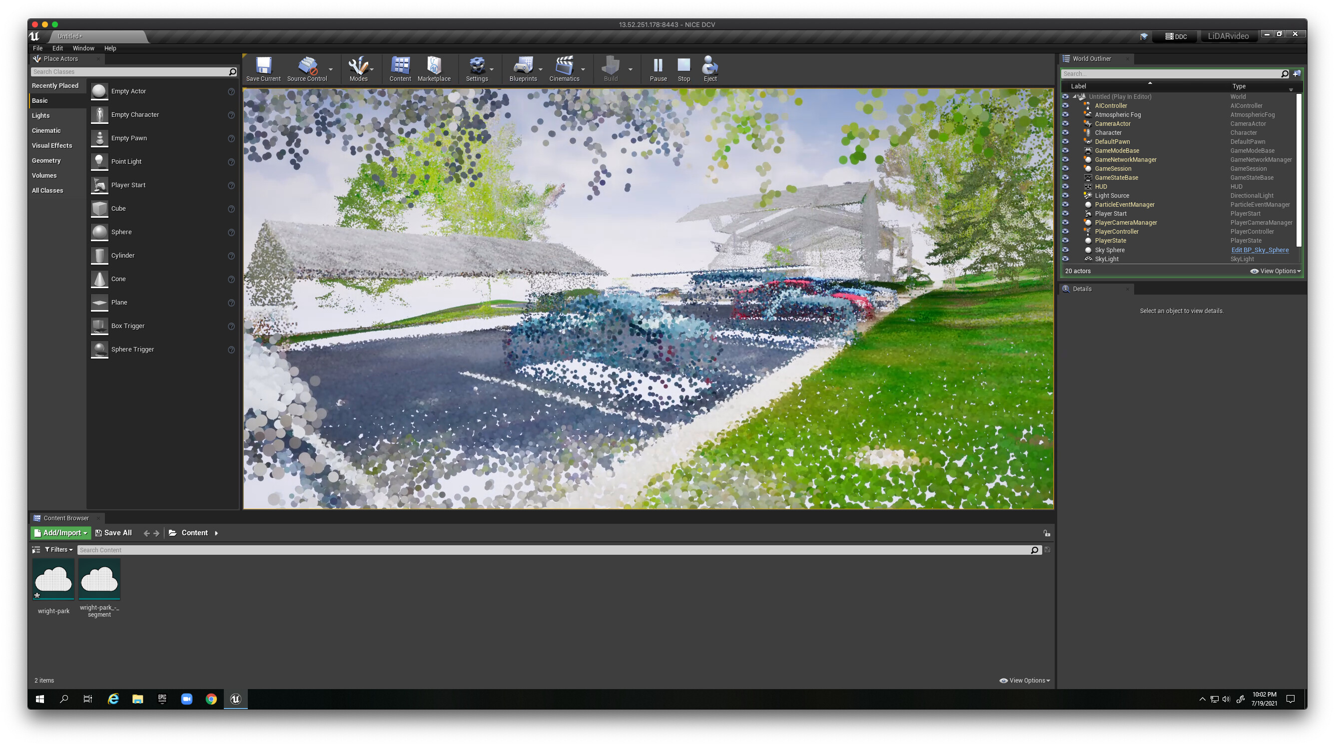
I just brought the data into CloudCompare, extracted a segment and imported that directly into Unreal Engine as .LAS

The initial LiDAR support came out in Unreal Engine 4.24 (I think) but its come along little by little since then (LiDAR point cloud support | Feature Highlight | Unreal Engine - YouTube), but the newest preview version 4.27 has support for .LAZ/.LAS file types so that was helpful to discover in order to be able to drag and drop a file from Rock Cloud into it. I had started with 4.26 and that file type wasn’t supported yet.

Here are some videos I watched to get started with it

Shaun Foster series
Part 1 - Overview
Part 2 - LiDAR in Unreal
Part 3 - LiDAR in Unreal - Previz

Matt Workman demo
Matt Workman BLK360 Scanning Studio

WPP did an interesting project with Innovair but I haven’t seen many details about it besides this marketing piece. WPP Innovair Video

Great to meet you and please share anything that might help!

1 Like