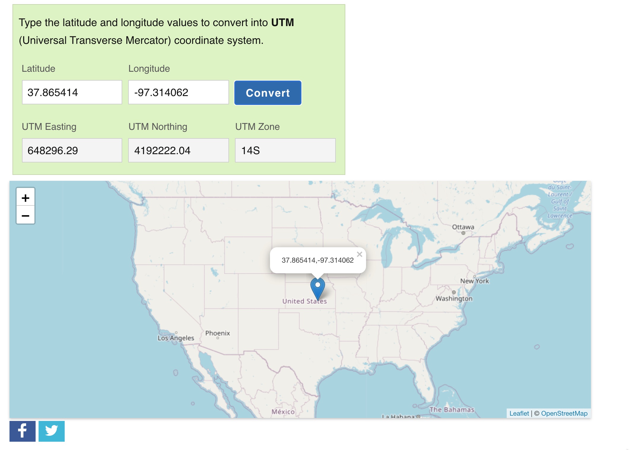
Here is where you might get lost! I am trying to find my UTM and the zone says 14S and I am in Wichita Kansas USA.
Actually, this is a little confusing. Because in this case I am actually in 14N (14 “Northern Hemisphere”). The online calculator uses the Latitude bands. Each UTM Zone is divided into 20 latitude bands starting from “C” at [80°S] and increasing up the English alphabet until “X”, omitting the letters “I” and “O” (because of their similarity to the numerals one and zero).
BUT!!! We usually dont use this notation. WE use the Northern and Southern Hemisphere notation. In this case, all that matters is the zone numer, in this case 14, and if you are in the Northern Hemisphere or the Southern.
So on this example the online tool reports the UTM zone 14 with the Latitude band “S”, but it is not normal to use this Latitude band notation and instead the hemisphere notation “N” for Norhtern
So in fact we are in UTM zone 14N
Use the https://www.latlong.net/lat-long-utm.html but replace the letter with either N for Northern hemisphere or S for southern.
Hope this helps